
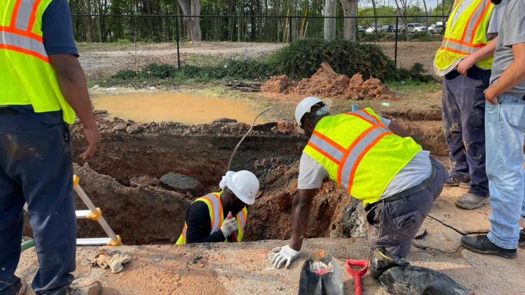
Avoid Project Delays with Pre-Dig Utility Mapping in Sacramento, CA
Sacramento’s construction sector generates $8.9 billion in annual project starts, creating constant demand for reliable subsurface information. Pre-dig utility mapping protects contractors from costly strikes that halt work, trigger regulatory fines, and endanger personnel.
Underground utilities include gas lines, water mains, electrical cables, telecommunications infrastructure, and storm drains. Accurate mapping before excavation prevents the 400,000 to 800,000 utility strikes that occur annually across the United States.
Key Takeaways
- Pre-dig utility mapping reduces utility strike risk by identifying underground infrastructure before excavation begins
- Nearly 50% of utility strikes occur due to inadequate locating, causing project delays and safety hazards
- Sacramento’s construction market generates $8.9 billion annually, driving demand for accurate utility detection services
- Subsurface utility engineering delivers average savings of $11.39 for every dollar invested in comprehensive mapping
- California regulations require immediate damage reporting and compliance with ASCE 38-22 quality standards
What Is Pre-Dig Utility Mapping and Why Is It Essential?
Pre-dig utility mapping identifies underground infrastructure locations before excavation begins. This process combines electromagnetic detection, radar imaging, and engineering analysis to create accurate subsurface records.
Nearly 50% of utility strikes result from inadequate locating practices. Project delay prevention starts with understanding what lies beneath the surface before equipment breaks ground.
What Technologies Are Used in Utility Mapping?
Pre-dig locating uses electromagnetic signals to trace conductive utilities like metal pipes and cables. Ground penetrating radar uses radar pulses to image the subsurface, detecting metallic and non-metallic objects.
Subsurface utility engineering combines civil engineering, surveying, and geophysics for survey-grade mapping. Quality Levels A-D per ASCE 38-22 classify utility data accuracy, while hydro excavation offers non-destructive methods for exposing utilities.
How Does Pre-Dig Mapping Prevent Project Delays?
Nearly 50% of utility strikes occur due to a lack of proper locating procedures. Between 400,000 and 800,000 utility strikes occur annually across the United States.
Project delays from work halting for inspections and repairs create cascading schedule impacts. Understanding utility marking regulations helps contractors maintain compliance while protecting project timelines.
Which Utility Mapping Services Are Offered in Sacramento?
Sacramento contractors access three primary mapping technologies based on project complexity and accuracy requirements. Service selection depends on site conditions, utility types, and budget constraints.
Pre-dig locating costs $150-$400 for residential sites and $800-$2,500 for commercial properties. Ground penetrating radar ranges from $400-$800 residential to $800-$1,500 per day commercially.
How Do Electromagnetic Locating and Ground Penetrating Radar Compare?
Pre-dig locating delivers cost-effective detection for metallic utilities at competitive rates. Electromagnetic locating cannot detect non-metallic utilities like PVC or concrete pipes.
Ground penetrating radar identifies both metallic and non-metallic subsurface features. GPR effectiveness depends on soil conditions and struggles in heavy clay environments.
What Is Subsurface Utility Engineering and When Is It Needed?
Subsurface utility engineering provides survey-grade mapping for complex industrial and campus projects. SUE costs range from $3,000 to $10,000+ for large-scale developments.
SUE requires premium pricing and extended time for comprehensive data collection. Choosing the best utility marking company ensures projects receive appropriate service levels.
What Factors Influence Selecting Utility Mapping Services?
Service selection balances technical requirements against budget and schedule constraints. Decision factors include accuracy needs, safety priorities, regulatory requirements, and data quality expectations.
Commercial contractors prioritize different factors than residential developers or municipal agencies. Cost considerations must account for potential strike damages rather than focusing solely on upfront service fees.
How Do Accuracy, Safety, and Compliance Rank in Priority?
Accuracy ranks highest with a priority score of 95, as precise location data prevents strikes. Safety scores 92, reflecting the need to protect crews and the public.
Regulatory compliance scores 88, driven by California Dig Safe Board requirements and ASCE standards. Data quality scores 85, reflecting demand for high-resolution, survey-grade deliverables.
What Role Does Cost and Timeliness Play in Decision-Making?
Cost ranks as a priority factor with a score of 82. Timeliness scores 78, reflecting contractor concerns about schedule delays.
Balancing upfront mapping costs against potential strike damages requires understanding true risk exposure. Utility marking benefits extend beyond immediate cost savings to long-term project protection.
How Does Sacramento’s Construction Market Drive Demand for Utility Mapping?
Sacramento construction contributes $34.8 billion in industry output and supports over 221,000 jobs. Market growth drives increasing demand for accurate pre-dig utility mapping services.
The region’s diverse contractor base creates varied service needs across commercial, residential, and municipal sectors. Sacramento construction delays from utility strikes impose high economic costs across the region.
What Are the Key Demographics of Contractors in Sacramento?
Commercial contractors represent 42% of Sacramento’s construction market, handling large-scale developments. Residential contractors represent 35%, focusing on housing developments and single-family projects.
Municipal contractors represent 15%, working on public infrastructure and right-of-way projects. Specialty services represent 8%, providing niche excavation and mapping technologies.
Where Are the Highest Utility Mapping Needs Within Sacramento Regions?
Downtown Sacramento accounts for 28% of regional demand due to dense legacy utilities. North Sacramento represents 22% from growing commercial and residential development zones.
South Sacramento contributes 18% through mixed residential and industrial projects. East Sacramento and West Sacramento each represent 16% of regional utility mapping demand.
How Should Contractors Plan and Execute Utility Mapping Projects?
Structured planning frameworks reduce utility strike risks and ensure regulatory compliance. Project assessment must evaluate site complexity, utility density, and required accuracy levels.
Downtown Sacramento sites require higher quality levels than rural locations. Compliance with utility marking regulations protects contractors from fines and legal liability.
What Are the Steps in the “Avoid Project Delays” Decision Framework?
Project scope assessment determines the complexity of the excavation site and the required mapping quality. Contractors must select appropriate technology combinations based on site conditions and utility types.
Data integration ensures utility information transfers into project design files before construction begins. Underground utility information must be verified and documented according to California standards.
Why Is Coordinating with 811 and Private Locators Critical?
Contact USA North 811 at least two business days before digging to mark public utilities. 811 only marks public lines up to the meter, creating responsibility gaps for private property utilities.
Engage private locators for utilities on private property beyond public service connections. Risks of not prioritizing utility marking include safety hazards, legal liability, and financial losses.
What Are the Costs and Benefits of Investing in Utility Mapping?
Utility strike costs extend far beyond immediate repair expenses to include project delays and legal exposure. Direct strike costs average $4,000, but the total impact reaches $29 for every dollar in direct damage.
Investment in pre-dig utility mapping delivers measurable returns through avoided strikes and schedule protection. Cost-benefit analysis demonstrates clear financial advantages of comprehensive mapping programs.
How Do Utility Strikes Impact Projects and Budgets?
The average direct cost of utility strikes reaches $4,000 for immediate repairs. True cost multipliers can reach $29 for every $1 in direct damage when accounting for indirect impacts.
Reputational damage and loss of future business opportunities compound financial losses. Safety hazards, including injury risk, explosions, or toxic leaks, create additional liability exposure, while regulatory fines and potential litigation further increase total costs.
What Is the Return on Investment for Subsurface Utility Engineering?
Every $1 invested in SUE delivers average savings of $11.39 across project lifecycles. SUE returns range from $4.62 to $22.21, depending on project complexity and site conditions.
Comprehensive mapping reduces change orders, eliminates rework, and protects project schedules. What to do if you hit a utility line becomes unnecessary when proper pre-dig mapping occurs.
How Do Regulatory Requirements Shape Utility Mapping Practices in Sacramento?
California regulations mandate immediate reporting of underground facility damage during excavation. Compliance protects contractors from fines, legal liability, and potential criminal prosecution.
State and federal standards establish minimum quality requirements for utility detection and documentation. Sacramento contractors must maintain current knowledge of evolving regulatory requirements.
What Are California’s Excavation Safety Laws and Standards?
Report any damage to underground facilities immediately per California regulations under Section 4100 of Title 19. California Dig Safe Board enforces excavation safety requirements across all project types.
Contractors face penalties for failing to contact 811 before digging or damaging unmarked utilities. State law requires verification of utility locations before any excavation begins.
How Do ASCE 38-22 and FHWA Guidelines Affect Project Compliance?
ASCE 38-22 establishes Quality Levels A through D for utility data accuracy and documentation. Federal-aid projects require utility certification confirming adequate coordination has occurred.
Quality Level A provides precise horizontal and vertical location data through direct exposure. FHWA guidelines mandate comprehensive utility investigations for federally funded transportation projects.
Integrating Pre-Dig Utility Mapping to Mitigate Risks and Ensure Project Success in Sacramento
Sacramento contractors reduce utility strikes by adopting comprehensive mapping programs before excavation begins. Pre-dig utility mapping protects budgets, schedules, and worker safety through accurate subsurface information.
Combining electromagnetic locating with ground penetrating radar ensures the detection of metallic and non-metallic utilities. Subsurface utility engineering provides survey-grade accuracy for complex projects requiring detailed infrastructure records.
Coastline Utility serves contractors across California’s Central Coast and SF Bay Area with advanced detection equipment and rapid response times. Their family-owned approach delivers personalized service while maintaining technical competence across commercial and residential projects.
Map Your Site Before the First Shovel Drops
Every Sacramento project carries the same hidden risk underground, and one strike can erase weeks of progress along with your margin. Coastline Utility takes the uncertainty out of excavation with electromagnetic locating, ground penetrating radar, and survey-grade subsurface utility engineering, so you know exactly what’s below before work begins. As a family-owned team, we pair precise detection with fast response and clear reporting you can hand straight to your project files. Contact Coastline Utility today to schedule pre-dig utility mapping and protect your timeline, your budget, and your crew.
