Clicky

Understanding utility marking regulations

Avoid Project Delays with Pre-Dig Utility Mapping in Sacramento, CA

Sacramento’s construction sector generates $8.9 billion in annual project starts, creating constant demand for reliable subsurface information. Pre-dig utility mapping protects contractors from costly strikes that halt work, trigger regulatory fines, and endanger personnel.

Underground utilities include gas lines, water mains, electrical cables, telecommunications infrastructure, and storm drains. Accurate mapping before excavation prevents the 400,000 to 800,000 utility strikes that occur annually across the United States.


Key Takeaways

  • Pre-dig utility mapping reduces utility strike risk by identifying underground infrastructure before excavation begins
  • Nearly 50% of utility strikes occur due to inadequate locating, causing project delays and safety hazards
  • Sacramento’s construction market generates $8.9 billion annually, driving demand for accurate utility detection services
  • Subsurface utility engineering delivers average savings of $11.39 for every dollar invested in comprehensive mapping
  • California regulations require immediate damage reporting and compliance with ASCE 38-22 quality standards

What Is Pre-Dig Utility Mapping and Why Is It Essential?

Pre-dig utility mapping identifies underground infrastructure locations before excavation begins. This process combines electromagnetic detection, radar imaging, and engineering analysis to create accurate subsurface records.

Nearly 50% of utility strikes result from inadequate locating practices. Project delay prevention starts with understanding what lies beneath the surface before equipment breaks ground.

What Technologies Are Used in Utility Mapping?

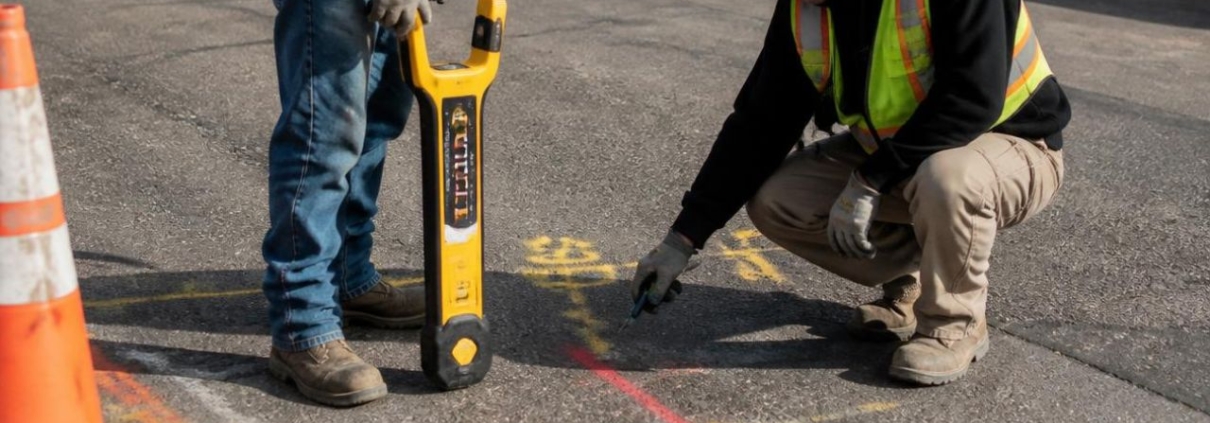
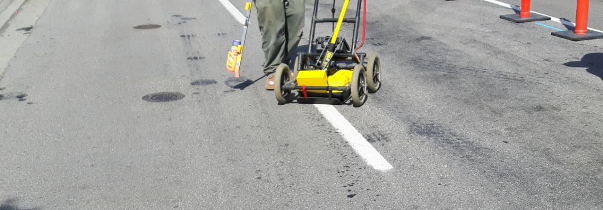
Pre-dig locating uses electromagnetic signals to trace conductive utilities like metal pipes and cables. Ground penetrating radar uses radar pulses to image the subsurface, detecting metallic and non-metallic objects.

Subsurface utility engineering combines civil engineering, surveying, and geophysics for survey-grade mapping. Quality Levels A-D per ASCE 38-22 classify utility data accuracy, while hydro excavation offers non-destructive methods for exposing utilities.

How Does Pre-Dig Mapping Prevent Project Delays?

Nearly 50% of utility strikes occur due to a lack of proper locating procedures. Between 400,000 and 800,000 utility strikes occur annually across the United States.

Project delays from work halting for inspections and repairs create cascading schedule impacts. Understanding utility marking regulations helps contractors maintain compliance while protecting project timelines.

Which Utility Mapping Services Are Offered in Sacramento?

Sacramento contractors access three primary mapping technologies based on project complexity and accuracy requirements. Service selection depends on site conditions, utility types, and budget constraints.

Pre-dig locating costs $150-$400 for residential sites and $800-$2,500 for commercial properties. Ground penetrating radar ranges from $400-$800 residential to $800-$1,500 per day commercially.

How Do Electromagnetic Locating and Ground Penetrating Radar Compare?

Pre-dig locating delivers cost-effective detection for metallic utilities at competitive rates. Electromagnetic locating cannot detect non-metallic utilities like PVC or concrete pipes.

Ground penetrating radar identifies both metallic and non-metallic subsurface features. GPR effectiveness depends on soil conditions and struggles in heavy clay environments.

What Is Subsurface Utility Engineering and When Is It Needed?

Subsurface utility engineering provides survey-grade mapping for complex industrial and campus projects. SUE costs range from $3,000 to $10,000+ for large-scale developments.

SUE requires premium pricing and extended time for comprehensive data collection. Choosing the best utility marking company ensures projects receive appropriate service levels.

What Factors Influence Selecting Utility Mapping Services?

Service selection balances technical requirements against budget and schedule constraints. Decision factors include accuracy needs, safety priorities, regulatory requirements, and data quality expectations.

Commercial contractors prioritize different factors than residential developers or municipal agencies. Cost considerations must account for potential strike damages rather than focusing solely on upfront service fees.

How Do Accuracy, Safety, and Compliance Rank in Priority?

Accuracy ranks highest with a priority score of 95, as precise location data prevents strikes. Safety scores 92, reflecting the need to protect crews and the public.

Regulatory compliance scores 88, driven by California Dig Safe Board requirements and ASCE standards. Data quality scores 85, reflecting demand for high-resolution, survey-grade deliverables.

What Role Does Cost and Timeliness Play in Decision-Making?

Cost ranks as a priority factor with a score of 82. Timeliness scores 78, reflecting contractor concerns about schedule delays.

Balancing upfront mapping costs against potential strike damages requires understanding true risk exposure. Utility marking benefits extend beyond immediate cost savings to long-term project protection.

How Does Sacramento’s Construction Market Drive Demand for Utility Mapping?

Sacramento construction contributes $34.8 billion in industry output and supports over 221,000 jobs. Market growth drives increasing demand for accurate pre-dig utility mapping services.

The region’s diverse contractor base creates varied service needs across commercial, residential, and municipal sectors. Sacramento construction delays from utility strikes impose high economic costs across the region.

What Are the Key Demographics of Contractors in Sacramento?

Commercial contractors represent 42% of Sacramento’s construction market, handling large-scale developments. Residential contractors represent 35%, focusing on housing developments and single-family projects.

Municipal contractors represent 15%, working on public infrastructure and right-of-way projects. Specialty services represent 8%, providing niche excavation and mapping technologies.

Where Are the Highest Utility Mapping Needs Within Sacramento Regions?

Downtown Sacramento accounts for 28% of regional demand due to dense legacy utilities. North Sacramento represents 22% from growing commercial and residential development zones.

South Sacramento contributes 18% through mixed residential and industrial projects. East Sacramento and West Sacramento each represent 16% of regional utility mapping demand.

How Should Contractors Plan and Execute Utility Mapping Projects?

Structured planning frameworks reduce utility strike risks and ensure regulatory compliance. Project assessment must evaluate site complexity, utility density, and required accuracy levels.

Downtown Sacramento sites require higher quality levels than rural locations. Compliance with utility marking regulations protects contractors from fines and legal liability.

What Are the Steps in the “Avoid Project Delays” Decision Framework?

Project scope assessment determines the complexity of the excavation site and the required mapping quality. Contractors must select appropriate technology combinations based on site conditions and utility types.

Data integration ensures utility information transfers into project design files before construction begins. Underground utility information must be verified and documented according to California standards.

Why Is Coordinating with 811 and Private Locators Critical?

Contact USA North 811 at least two business days before digging to mark public utilities. 811 only marks public lines up to the meter, creating responsibility gaps for private property utilities.

Engage private locators for utilities on private property beyond public service connections. Risks of not prioritizing utility marking include safety hazards, legal liability, and financial losses.

What Are the Costs and Benefits of Investing in Utility Mapping?

Utility strike costs extend far beyond immediate repair expenses to include project delays and legal exposure. Direct strike costs average $4,000, but the total impact reaches $29 for every dollar in direct damage.

Investment in pre-dig utility mapping delivers measurable returns through avoided strikes and schedule protection. Cost-benefit analysis demonstrates clear financial advantages of comprehensive mapping programs.

How Do Utility Strikes Impact Projects and Budgets?

The average direct cost of utility strikes reaches $4,000 for immediate repairs. True cost multipliers can reach $29 for every $1 in direct damage when accounting for indirect impacts.

Reputational damage and loss of future business opportunities compound financial losses. Safety hazards, including injury risk, explosions, or toxic leaks, create additional liability exposure, while regulatory fines and potential litigation further increase total costs.

What Is the Return on Investment for Subsurface Utility Engineering?

Every $1 invested in SUE delivers average savings of $11.39 across project lifecycles. SUE returns range from $4.62 to $22.21, depending on project complexity and site conditions.

Comprehensive mapping reduces change orders, eliminates rework, and protects project schedules. What to do if you hit a utility line becomes unnecessary when proper pre-dig mapping occurs.

How Do Regulatory Requirements Shape Utility Mapping Practices in Sacramento?

California regulations mandate immediate reporting of underground facility damage during excavation. Compliance protects contractors from fines, legal liability, and potential criminal prosecution.

State and federal standards establish minimum quality requirements for utility detection and documentation. Sacramento contractors must maintain current knowledge of evolving regulatory requirements.

What Are California’s Excavation Safety Laws and Standards?

Report any damage to underground facilities immediately per California regulations under Section 4100 of Title 19. California Dig Safe Board enforces excavation safety requirements across all project types.

Contractors face penalties for failing to contact 811 before digging or damaging unmarked utilities. State law requires verification of utility locations before any excavation begins.

How Do ASCE 38-22 and FHWA Guidelines Affect Project Compliance?

ASCE 38-22 establishes Quality Levels A through D for utility data accuracy and documentation. Federal-aid projects require utility certification confirming adequate coordination has occurred.

Quality Level A provides precise horizontal and vertical location data through direct exposure. FHWA guidelines mandate comprehensive utility investigations for federally funded transportation projects.

Integrating Pre-Dig Utility Mapping to Mitigate Risks and Ensure Project Success in Sacramento

Sacramento contractors reduce utility strikes by adopting comprehensive mapping programs before excavation begins. Pre-dig utility mapping protects budgets, schedules, and worker safety through accurate subsurface information.

Combining electromagnetic locating with ground penetrating radar ensures the detection of metallic and non-metallic utilities. Subsurface utility engineering provides survey-grade accuracy for complex projects requiring detailed infrastructure records.

Coastline Utility serves contractors across California’s Central Coast and SF Bay Area with advanced detection equipment and rapid response times. Their family-owned approach delivers personalized service while maintaining technical competence across commercial and residential projects.

Map Your Site Before the First Shovel Drops

Every Sacramento project carries the same hidden risk underground, and one strike can erase weeks of progress along with your margin. Coastline Utility takes the uncertainty out of excavation with electromagnetic locating, ground penetrating radar, and survey-grade subsurface utility engineering, so you know exactly what’s below before work begins. As a family-owned team, we pair precise detection with fast response and clear reporting you can hand straight to your project files. Contact Coastline Utility today to schedule pre-dig utility mapping and protect your timeline, your budget, and your crew.

private locating services

Private Utility Locating for Commercial Renovations in Sacramento, CA

Commercial renovation projects require comprehensive subsurface infrastructure mapping to prevent costly utility strikes and regulatory violations. Private utility locating services identify water lines, electrical conduits, irrigation systems, and telecommunications infrastructure beyond public meter connections that 811 systems do not cover. Sacramento contractors face strict California regulations requiring advanced detection technologies and documentation standards that protect against financial liability while ensuring worker safety.

Urban subsurface network complexity has increased demand for private utility surveys among commercial developers and renovation specialists. Projects involving foundation work, underground parking installation, or utility relocation depend on accurate mapping to maintain schedules and budgets. Contractors who prioritize private locating services reduce strike risks while satisfying regulatory compliance requirements.


Key Takeaways

  • Private utility locating covers 60% of subsurface infrastructure not included in free 811 services
  • Utility strikes cost contractors an average of $4,000 in direct repairs, with indirect costs multiplying by 29
  • Ground Penetrating Radar detects both metallic and non-metallic utilities, unlike electromagnetic methods
  • California enforces tolerance zones of 18-24 inches around marked utilities requiring hand excavation
  • The North American utility locating market will reach $4.11 billion by 2032, with 7.3% annual growth

What Is Private Utility Locating and Why Is It Essential?

Private utility locating identifies subsurface infrastructure on private property beyond public utility connection points using electromagnetic detection, Ground Penetrating Radar, and vacuum excavation to map utilities that property owners maintain and control.

Commercial renovation utility locating prevents damage to infrastructure that 811 services do not mark or document. Accurate subsurface mapping protects contractors from legal liability while ensuring project timelines remain intact.

What Differentiates Private Utility Locating from Public Services?

The 811 system marks public utilities only up to the meter connection, where responsibility transfers to property owners, creating a responsibility gap covering private infrastructure representing 60% of total subsurface utilities. Public locating services exclude private water lines, electrical conduits serving outbuildings, irrigation networks, or telecommunications cables installed by property owners.

Private utilities beyond the meter remain unmapped by free 811 services despite their prevalence across commercial properties. Understanding the regulations surrounding utility line marking in California helps contractors navigate this complex responsibility structure.

Which Utilities Are Covered by Private Locating?

Private locating services identify water lines extending from meter connections to buildings and landscape irrigation systems. Electrical conduits powering detached structures, security lighting, and site equipment fall under private utility categories. Underground telecommunications cables, fiber-optic lines, and data transmission infrastructure installed for specific properties require private detection methods.

Irrigation systems represent a significant portion of private utilities on Sacramento commercial projects, requiring careful mapping. Private water mains, fire suppression lines, and drainage systems all fall outside public 811 coverage boundaries.

Why Is Private Utility Locating Critical for Commercial Renovations?

Direct repair costs average $4,000 per utility strike, with indirect costs multiplying this figure by 29. Service disruptions create cascading delays affecting project schedules, labor allocation, and client relationships. Legal liability for contractors includes both repair costs and penalties for regulatory violations that can reach six figures.

Safety hazards from striking gas or electrical lines create immediate dangers requiring emergency response and site evacuation. Workers face electrocution risks from damaged electrical conduits and explosion hazards from ruptured gas lines. The risks of not prioritizing utility marking for construction sites extend beyond financial losses to include serious injury potential and project shutdowns.

How Do Sacramento Contractors Prioritize Utility Locating Services?

Sacramento contractors allocate resources across multiple service categories based on project requirements and regulatory obligations. Private utility locating services command 35% of market share, reflecting the critical gap in public 811 coverage. Commercial excavation support captures 28% of spending, while liability risk mitigation services account for 22% of contractor investments.

Concrete scanning services represent 10% of market activity, with the remaining demand distributed across specialized applications. These allocation patterns demonstrate how contractors balance cost control against strike prevention across Sacramento commercial projects.

What Are the Key Service Categories Used by Contractors?

Private utility locating services dominate contractor spending at 35% of the total market share for subsurface detection. Commercial excavation support captures 28% through comprehensive site scanning and subsurface mapping. Liability risk mitigation services account for 22% through documentation and compliance verification.

Concrete scanning represents 10% of market activity focused on identifying rebar and post-tension cables in existing structures. Other specialized services, including leak detection and underground storage tank location, comprise the remaining 5%.

How Do Accuracy and Compliance Influence Provider Choice?

Contractors rank accuracy in depth and location determination as their highest priority at 28% importance ratings. Regulatory compliance capabilities account for 24% of the selection criteria, reflecting California’s strict excavation laws. Speed of service represents 22% of decision factors as project schedules demand rapid turnaround for locating activities.

Cost efficiency influences 16% of provider selection decisions, balancing budget constraints against accuracy requirements for renovation utility mapping. Safety standards account for 10%, reflecting contractor obligations for worker protection. Choosing the best utility marking company for your business needs requires evaluating these factors against specific project requirements.

Which Contractor Types Most Frequently Adopt Private Locating?

Municipal contractors demonstrate 92% adoption rates driven by strict public works requirements. Excavation specialists show 85% adoption rates as their core operations depend entirely on safe digging practices. Utility companies maintain 78% adoption rates for internal projects involving infrastructure expansion and maintenance.

General contractors achieve 72% adoption rates across diverse project types requiring subsurface clearance. Commercial renovators report 68% adoption rates reflecting growing awareness of private utility risks in Sacramento commercial projects.

What Technologies Are Used for Utility Locating in Sacramento?

Electromagnetic locating provides fast, cost-effective detection for metallic utilities, including copper water lines and steel gas pipes. Ground Penetrating Radar delivers comprehensive scanning capabilities, detecting both metallic and non-metallic infrastructure with excellent depth penetration. Acoustic methods and vacuum excavation offer specialized detection and verification capabilities for complex subsurface environments.

Technology selection depends on utility types, soil conditions, and accuracy requirements specific to each Sacramento renovation project. Contractors often combine multiple detection methods to achieve comprehensive subsurface mapping. Advanced providers integrate these technologies with GPS positioning and 3D mapping software for precise documentation.

How Do Electromagnetic and Ground Penetrating Radar Compare?

Electromagnetic locating excels at detecting metallic utilities with fast scanning speeds and low operational costs. However, electromagnetic methods cannot detect PVC pipes, concrete conduits, or fiber-optic cables common in modern Sacramento commercial projects. This technology provides moderate depth capability suitable for utilities within six feet of the surface.

Ground Penetrating Radar detects both metallic and non-metallic utilities with excellent depth capability reaching fifteen feet or deeper. GPR equipment costs significantly more than electromagnetic locators and requires moderate scanning speeds for thorough coverage. GPR struggles in high-clay soils common throughout California, requiring experienced operators to interpret subsurface reflections accurately.

When Are Vacuum Excavation and Acoustic Methods Applied?

Acoustic and sonic methods provide good detection for both metallic and non-metallic utilities with moderate depth capabilities. These technologies cost more than electromagnetic locating but less than Ground Penetrating Radar, with moderate scanning speeds for focused investigation areas.

Vacuum excavation delivers Quality Level A data through visual confirmation of subsurface utility locations and depths. Potholing in California provides definitive verification but carries high costs and slow operational speeds compared to remote sensing methods. Contractors use vacuum excavation strategically at critical conflict points where absolute certainty justifies the additional expense.

What Are the Cost and Speed Trade-offs Among These Technologies?

Electromagnetic locating offers the fastest scanning speeds at the lowest costs, making it ideal for initial surveys across large sites. Ground Penetrating Radar balances comprehensive detection capabilities against higher equipment costs and moderate operational speeds, providing the best return on investment for complex projects requiring complete subsurface mapping.

Vacuum excavation represents the slowest and most expensive detection method, but it delivers absolute verification, eliminating uncertainty. Contractors optimize technology selection by using electromagnetic or GPR methods for initial mapping, followed by targeted vacuum excavation, controlling costs while ensuring accuracy at critical utility crossing points.

How Do California Regulations Impact Utility Locating Practices?

California requires contractors to contact USA North 811 at least two business days before digging activities commence. State regulations enforce strict tolerance zones around marked utilities requiring hand excavation within 18-24 inches of identified infrastructure. These requirements create compliance obligations that significantly influence utility locating practices throughout Sacramento.

Regulatory frameworks establish liability standards holding contractors responsible for utility strikes resulting from inadequate investigation or improper excavation methods. Penalties range from state fines up to $100,000 to federal pipeline safety violations reaching $2,000,000 for serious incidents. Compliance costs continue rising with projected increases of 10% in 2025.

What Is the Role of the 811 System and Its Limitations?

The 811 system provides free utility marking for public infrastructure up to property meter connections throughout California. Contractors must contact USA North 811 at least two business days before excavation. Public locating services cover water, gas, electrical, and telecommunications infrastructure owned and maintained by utility companies.

System limitations create responsibility gaps for private utilities beyond meter connections that property owners control. This 60% of subsurface infrastructure remains unmapped by 811 services despite representing significant strike risks. Underground utilities in California extend well beyond public systems, requiring comprehensive private locating services for complete subsurface mapping.

How Do Tolerance Zones and Excavation Methods Affect Compliance?

California enforces tolerance zones of 18-24 inches around marked utilities where mechanized equipment is strictly prohibited. Contractors must use hand tools or vacuum excavation within these zones to prevent strikes. Mechanized equipment operation within tolerance zones constitutes regulatory violations regardless of whether actual utility damage occurs.

Hand excavation increases labor costs but provides precise control, reducing strike risks near identified utilities. Vacuum excavation offers non-destructive investigation within tolerance zones, combining speed advantages with regulatory compliance for Sacramento commercial projects.

What Are the Liability Risks and Penalties for Utility Strikes?

California imposes state-level fines reaching $100,000 for excavation violations, including inadequate investigation and improper digging methods. Federal Pipeline and Hazardous Materials Safety Administration penalties can reach $2,000,000 for pipeline damages. Direct repair costs average $4,000 per strike, with indirect costs including delays, legal fees, and reputational damage multiplying this by 29.

Contractors face criminal liability for gross negligence causing injuries or fatalities from utility strikes. Insurance premiums increase following strike incidents, while severe violations can result in license suspensions or revocations. These consequences make comprehensive private utility surveys essential risk management investments.

What Are the Best Practices for Managing Liability and Project Risks?

Private utility locating mitigates legal exposure by documenting subsurface infrastructure before excavation activities commence on Sacramento commercial projects. Comprehensive detection services provide defensible records demonstrating due diligence in utility investigation and strike prevention efforts. Contractors who invest in thorough locating services significantly reduce liability risks while protecting project budgets and schedules.

Documentation and verification processes establish clear chains of custody proving compliance with California excavation regulations and industry standards. Integration of locating data into project planning enables proactive conflict resolution before construction activities encounter subsurface obstacles.

How Does Private Locating Mitigate Legal and Financial Exposure?

Private locating services document subsurface conditions, providing evidence of reasonable investigation efforts during excavation projects. This documentation establishes legal defenses against negligence claims resulting from utility strikes. Comprehensive mapping reduces strike frequency, protecting project budgets from repair costs and schedule delays averaging tens of thousands of dollars.

Insurance carriers recognize private locating as effective risk mitigation, reducing premium costs and claim frequencies. Legal protections extend to regulatory compliance, demonstrating adherence to California excavation requirements. Four reasons why utility marking is crucial for your home improvement project apply equally to commercial renovations requiring similar liability protections.

What Documentation and Verification Processes Are Recommended?

Subsurface Utility Engineering follows ASCE 38-22 standards, establishing four quality levels from preliminary research to visual verification. Quality Level D provides a desktop review of existing records, while Level C adds surface geophysical surveys. Quality Level B delivers horizontal positioning through surveyed measurements, while Level A requires visual confirmation through vacuum excavation.

Documentation packages should include marked site plans, depth measurements, utility classifications, and photographic evidence. GPS coordinates and GIS integration enable precise location tracking, supporting future excavation activities and facility management throughout building lifecycles. Digital documentation systems provide searchable archives accessible to multiple project stakeholders.

How Do Contractors Integrate Locating Data Into Project Planning?

Integration begins during pre-construction phases when locating data informs site layout decisions and excavation sequencing strategies. CAD software imports utility mapping data, enabling conflict analysis between proposed construction activities and existing subsurface infrastructure, preventing design conflicts that would otherwise require costly field modifications.

Excavation contractors use locating data to optimize equipment selection and digging methods based on utility locations and depths. Project managers incorporate buffer zones around identified utilities into construction schedules, allowing adequate clearances for safe excavation. Real-time access to digital locating data enables field crews to make informed decisions when encountering unexpected subsurface conditions.

Which Market Trends Are Shaping Utility Locating in Sacramento?

The global private utility locating market reached $1.82 billion in 2024, with projections indicating growth to $2.68 billion by 2032, representing a compound annual growth rate of 5.7% driven by infrastructure modernization and regulatory compliance demands. The broader utility locator market, including equipment and public services, was valued at $913.78 million in 2024, with projections reaching $1.48 billion by 2032 at 6.28% annual growth.

North American markets dominate global activity, accounting for 36.8% of market share in 2023. Regional markets demonstrate accelerated growth rates exceeding global averages as aging infrastructure requires replacement and renovation activities intensify.

How Are Technological Advances Influencing Locating Services?

Advanced Ground Penetrating Radar systems deliver higher resolution imaging, enabling detection of smaller utilities and precise depth measurements. GPS integration provides centimeter-level positioning accuracy, supporting Geographic Information System mapping and digital twin creation. Mobile applications enable real-time data sharing between field crews and project managers, improving decision-making during excavation.

3D visualization software transforms subsurface data into interactive models, helping contractors understand complex utility networks before excavation. Artificial intelligence algorithms assist in GPR data interpretation, reducing operator training requirements while improving detection accuracy. These technological advances lower operational costs while improving service quality throughout Sacramento commercial renovation projects.

What Regional Differences Affect Service Adoption and Methods?

North America accounted for 36.8% of the global market share in 2023, with values reaching $2.33 billion in 2024. Regional projections indicate growth to $4.11 billion by 2032, representing compound annual growth of 7.3%. This accelerated growth reflects stringent regulatory requirements and extensive infrastructure networks requiring ongoing maintenance.

California’s complex subsurface environments and strict excavation regulations drive higher adoption rates compared to national averages. Urban Sacramento projects demand comprehensive Ground Penetrating Radar scanning, while suburban developments may rely more heavily on electromagnetic detection. Soil composition variations throughout the region influence technology selection, with clay-heavy areas requiring specialized GPR interpretation expertise.

How Are Costs and Regulatory Requirements Evolving Over Time?

Budget tier private utility locating services range from $150 to $400 for simple residential applications using electromagnetic detection only. Mid-range services cost $400 to $800 for residential projects requiring Ground Penetrating Radar verification. Premium residential and small commercial projects exceed $800, reflecting complex site conditions.

Commercial excavation support services range from $800 to $2,500 for small commercial sites covering one to five acres. Mid-range commercial projects spanning five or more acres cost $3,000 to $10,000 for complete subsurface mapping. Complex industrial or campus-wide mapping projects exceed $15,000 to $25,000, reflecting extensive survey areas and Quality Level A verification requirements.

How Are Private Utility Locating Services Applied in Sacramento Renovations?

Case studies from Sacramento commercial projects demonstrate substantial return on investment from comprehensive private utility locating services. A downtown Sacramento contractor prevented $45,000 in damages by identifying three abandoned gas lines and an active private water main. These utilities were not documented on city maps, highlighting the critical value of thorough subsurface investigation.

Commercial campus projects benefit from pre-construction utility mapping that enables proactive coordination between renovation activities and existing infrastructure. Ground Penetrating Radar scans reveal unmarked private utility lines, allowing design adjustments before excavation activities encounter conflicts.

What Do Case Studies Reveal About Utility Locating Benefits?

A downtown Sacramento contractor renovating a historic building near the State Capitol required extensive trenching for new fiber-optic installations. Private utility locating using electromagnetic and Ground Penetrating Radar methods identified three abandoned gas lines and an active private water main, preventing an estimated $45,000 in potential damages and avoiding project delays that would have multiplied costs.

A commercial campus project contracted private locators to scan a multi-acre site before soil boring activities commenced. The Ground Penetrating Radar scan revealed that several proposed boring locations were directly above unmarked private utility lines. Adjusted boring coordinates allowed environmental testing to proceed safely, demonstrating how private utility surveys enable successful project execution.

How Does Locating Support Pre-Construction and Excavation Phases?

Pre-construction utility mapping enables accurate cost estimating by identifying subsurface conflicts requiring design modifications or specialized excavation methods. Design teams use locating data to optimize building placement, utility routing, and site access strategies before construction documents reach completion, preventing costly change orders.

Excavation phase support provides real-time verification as contractors expose utilities during digging activities, confirming pre-construction mapping accuracy. Field locating services respond quickly to unexpected subsurface discoveries, enabling rapid decision-making that maintains project schedules. Continuous locating support protects against strikes while providing documentation supporting regulatory compliance and quality assurance requirements.

What Challenges Arise in Urban Versus Suburban Renovation Projects?

Urban Sacramento projects encounter dense subsurface networks, including decades of abandoned utilities, creating complex detection challenges. Historic buildings often lack accurate as-built documentation, requiring comprehensive Ground Penetrating Radar scanning to map existing conditions. High-clay soils common in urban areas complicate GPR interpretation, requiring experienced operators to distinguish utilities from geological features.

Suburban renovation projects typically feature newer infrastructure with better documentation, reducing detection complexity compared to urban environments. Lower utility density simplifies subsurface mapping but does not eliminate strike risks from unmarked private utilities. Suburban sites may include extensive irrigation systems and private drainage networks requiring thorough investigation despite seemingly straightforward surface conditions.

Private Utility Locating for Commercial Renovations in Sacramento: Integrated Solutions for Risk Reduction and Regulatory Compliance

Private utility locating has become essential infrastructure for Sacramento commercial renovation projects requiring comprehensive subsurface mapping beyond public 811 coverage. Advanced technologies, including Ground Penetrating Radar and vacuum excavation, enable accurate detection of both metallic and non-metallic utilities. Contractors who prioritize private locating services significantly reduce liability exposure while ensuring regulatory compliance.

Market growth projections indicate continued expansion as infrastructure complexity increases and regulatory requirements become more stringent across California. Technology integration with GPS positioning and 3D mapping software provides contractors with powerful tools for proactive project planning. Comprehensive utility locating protects project budgets, maintains schedules, and ensures worker safety across Sacramento commercial projects of all scales.

Coastline Utility provides specialized subsurface detection services, helping contractors navigate complex utility networks throughout California commercial projects. Professional locating services deliver the accuracy and documentation necessary for successful renovation project execution.

Map What’s Below Before You Break Ground

Commercial renovations don’t leave room for surprises underground. A single strike on an unmarked private line can stall your schedule, drain your budget, and put your crew at risk. Coastline Utility locates the water lines, electrical conduits, irrigation networks, and telecom infrastructure that 811 leaves unmarked, then hands you clear documentation that holds up against California compliance requirements.

Get accurate subsurface mapping before the first cut. Contact our team to schedule a private utility locating for your commercial renovation.

preliminary dig mapping

Utility Mapping Services for Sacramento Excavation Projects

Utility mapping services locate underground infrastructure before excavation begins to prevent costly strikes. These services use electromagnetic signals, ground penetrating radar, and survey-grade engineering to identify pipes, cables, and conduits beneath construction sites.

Sacramento’s $8.9 billion construction market requires accurate utility data to avoid project delays and safety hazards. Contractors must coordinate with 811 services while hiring private locators for utilities on private property that falls outside public marking requirements.


Key Takeaways

  • Pre-dig electromagnetic locating traces metallic utilities, but cannot detect PVC or concrete pipes
  • Ground penetrating radar identifies both metallic and non-metallic utilities when soil conditions permit
  • Every dollar invested in subsurface utility engineering delivers average savings of $11.39
  • Nearly 50% of utility strikes occur due to inadequate locating before excavation
  • Sacramento construction starts reached $8.9 billion in 2024, creating strong demand for utility mapping

What are Utility Mapping Services and Why are They Essential?

Utility mapping services document the location of underground infrastructure using electromagnetic detection, radar imaging, and civil engineering surveys. These methods prevent excavation damage by providing contractors with precise data about pipe depths, cable routes, and subsurface obstructions before digging begins.

Sacramento’s aging infrastructure and dense urban development make preliminary dig mapping essential for construction safety. Accurate utility data reduces the risk of striking gas lines, electrical cables, or water mains during excavation.

Definitions and Core Functions of Utility Mapping

Pre-dig locating uses electromagnetic signals to trace conductive utilities such as metal pipes and electrical cables. Ground penetrating radar sends radar pulses into the subsurface to detect both metallic and non-metallic objects, including PVC pipes and concrete conduits.

Subsurface utility engineering combines civil engineering, surveying, and geophysics to provide survey-grade mapping classified by Quality Levels A through D per ASCE 38-22 standards. GIS mapping creates permanent digital records of utility infrastructure for long-term project coordination and maintenance planning.

Key Technologies in Utility Detection: EM Locating, GPR, and SUE

Hydro excavation exposes utilities using pressurized water, providing a non-destructive method for verification. Electromagnetic locating cannot detect non-metallic utilities such as PVC or concrete pipes, limiting its effectiveness for comprehensive site assessment.

Ground penetrating radar effectiveness depends on soil conditions and struggles in heavy clay soils common throughout Sacramento. Subsurface utility engineering requires premium pricing due to extensive data collection, processing, and survey-grade deliverables.

Purpose and Benefits for Excavation Projects in Sacramento

Subsurface utility engineering delivers average savings of $11.39 for every dollar invested, with ROI ranging from $4.62 to $22.21. Nearly 50% of utility strikes occur due to inadequate locating before excavation begins.

Sacramento construction starts are projected at $8.9 billion in 2024, driving demand for reliable utility mapping services. The construction sector contributes $34.8 billion in industry output, supporting over 221,000 jobs across the region.

How Do Consumer Preferences Shape Utility Mapping Service Adoption?

Contractors prioritize accuracy, safety, and regulatory compliance when selecting excavation utility mapping providers. These factors determine project success by preventing utility strikes that cause delays, injuries, and costly repairs.

Technology adoption among Sacramento contractors reflects the shift toward digital documentation and real-time data integration. Contractors increasingly demand services that combine multiple detection methods for comprehensive subsurface analysis.

Accuracy, Safety, and Regulatory Compliance as Top Priorities

Accuracy scores 95 out of 100 as the most critical factor for contractors selecting utility mapping services. Safety ranks at 92, followed by regulatory compliance at 88, data quality at 85, and cost at 82.

Contractors recognize that precise utility data prevents strikes and protects crews from hazardous exposures. Regulatory compliance with California Dig Safe Board rules and ASCE 38-22 standards reduces legal liability for excavation projects.

Trends in Technology Adoption Among Sacramento Contractors

Digital field reports are utilized by 67% of contractors for documenting utility locations and project conditions. Digital time tracking has been adopted by 59% of contractors, while 57% use digital field job information access.

These adoption rates demonstrate the construction industry’s transition toward paperless workflows and cloud-based data management. Contractors expect utility locator contractors to provide digital deliverables that integrate with existing project management systems.

Market Segmentation by Service Types and Demand Distribution

Pre-dig locating holds 45% market share due to cost-effectiveness for residential and small commercial projects. GIS mapping accounts for 28% of the market, reflecting demand for permanent utility records.

Subsurface utility engineering represents 18% of the market for complex projects requiring survey-grade accuracy. Hydro excavation makes up 9% of market demand as a verification and exposure method.

What are the Main Utility Mapping Methods Used in Sacramento?

Electromagnetic locating, ground penetrating radar, and subsurface utility engineering serve distinct project needs based on complexity and budget. Each method offers specific advantages for detecting different types of underground infrastructure.

Sacramento contractors select mapping methods based on site conditions, utility types, and regulatory requirements. Combining multiple technologies provides comprehensive coverage that reduces the risk of missed utilities during excavation.

Pre-Dig Electromagnetic Locating: Strengths and Limitations

Electromagnetic locating costs $150 to $400 for residential lots and $800 to $2,500 for commercial sites. This method excels at tracing metallic utilities, including copper water lines, steel gas pipes, and electrical conduits.

Electromagnetic signals cannot detect non-metallic utilities such as PVC sewer lines or concrete storm drains. Contractors must supplement EM locating with additional technologies when non-conductive utilities are present on site.

Ground Penetrating Radar: Capabilities and Challenges

Ground penetrating radar costs $400 to $800 for residential projects and $800 to $1,500 per day for commercial applications. GPR detects both metallic and non-metallic objects by analyzing radar wave reflections from subsurface materials.

GPR performance degrades in heavy clay soils and saturated conditions common in Sacramento during the winter months. Contractors should verify soil conditions before selecting GPR for Sacramento excavation services to ensure optimal detection results.

Subsurface Utility Engineering: Survey-Grade Mapping and Use Cases

Subsurface utility engineering costs $3,000 to $10,000 or more for large industrial or campus projects. SUE provides survey-grade accuracy classified as Quality Level A or B under ASCE 38-22 standards.

SUE requires additional time for data collection and processing compared to basic locating services. This method is appropriate for projects where utility strike risks justify premium pricing and extended timelines.

How Does Regional Demographics Influence Utility Mapping Needs?

Sacramento’s construction market demographics determine the types of utility mapping services contractors require. Commercial projects demand comprehensive SUE documentation, while residential developments often use electromagnetic locating for routine excavations.

The distribution of construction activity across Sacramento neighborhoods creates geographic variations in service demand. Downtown areas with legacy infrastructure require advanced detection methods compared to newer suburban developments.

Sacramento Construction Market Overview and Growth Drivers

Sacramento’s construction sector supports over 221,000 jobs across residential, commercial, and municipal projects. The $1.3 billion Sacramento International Airport improvement plan represents a major infrastructure investment, driving demand for utility coordination services.

Construction activity generates demand for accurate utility mapping to prevent strikes during site development. Project managers must balance mapping costs against potential delays from striking unmarked underground infrastructure.

Contractor Types and Their Specific Utility Mapping Requirements

Commercial contractors represent 42% of the Sacramento market and require comprehensive utility mapping for complex sites. Residential contractors account for 35% of demand, focusing on cost-effective electromagnetic locating for housing developments.

Municipal contractors represent 15% of the market and must comply with strict federal and state utility coordination requirements. Specialty services make up 8% of demand, often requiring customized detection methods for unique project conditions.

Geographic Demand Distribution Across Sacramento Areas

Downtown Sacramento accounts for 28% of utility mapping demand due to dense urban infrastructure and aging utilities. North Sacramento generates 22% of demand from growing commercial and residential development zones.

South Sacramento produces 18% of demand with mixed residential and industrial projects requiring varied detection approaches. East Sacramento and West Sacramento each account for 16% of demand, reflecting established neighborhoods and expanding urban areas.

What are the Risks and Costs of Inadequate Utility Mapping?

Inadequate utility mapping leads to 400,000 to 800,000 utility strikes annually across the United States. Nearly 50% of these strikes result from insufficient locating before excavation begins.

The consequences of utility strikes extend beyond immediate repair costs to include project delays and legal liability. Understanding these risks helps contractors justify investing in comprehensive utility mapping before breaking ground.

Frequency and Causes of Utility Strikes During Excavation

Utility strikes occur when excavators contact underground infrastructure that was not properly located before digging. Strikes result from incomplete mapping, inaccurate utility records, or failure to use appropriate detection technologies.

Nearly half of all strikes happen because contractors skip proper locating or rely only on 811 marking for public utilities. Private property utilities remain unmarked unless contractors hire private locators to supplement 811 services.

Direct and Indirect Costs Associated with Utility Strikes

The average direct cost of a utility strike is $4,000 for immediate repairs and service restoration. However, the true cost multiplier reaches up to $29 for every dollar in direct damage when including project delays, legal fees, and reputational harm.

Hidden costs include crew downtime, equipment mobilization, regulatory fines, and potential litigation from affected parties. These indirect expenses often exceed repair costs and can jeopardize contractor relationships with clients and future bidding opportunities.

ROI of Investing in Comprehensive Utility Mapping Like SUE

Every dollar invested in subsurface utility engineering delivers average savings of $11.39 through avoided strikes and reduced project delays. The ROI ranges from $4.62 to $22.21, depending on project complexity and site conditions.

Comprehensive mapping prevents schedule disruptions that cascade through construction timelines and affect multiple trades. Contractors who invest in quality utility data maintain competitive advantages through improved safety records and on-time project completion.

How Should Project Teams Approach Utility Mapping for Excavation?

Project teams must follow a structured approach to utility mapping that addresses both public and private infrastructure. This framework ensures comprehensive coverage while maintaining regulatory compliance and cost-effectiveness.

Successful utility mapping requires coordination between 811 services, private locators, and engineering consultants. Each stakeholder contributes specific expertise to create complete subsurface documentation before excavation begins.

Step-by-Step Decision-Making Framework for Sacramento Projects

Contact USA North 811 at least two business days before digging to initiate public utility marking. Assess project scope based on site complexity, with urban areas requiring Quality Level A or B documentation under ASCE 38-22.

Engage private locators for utilities on private property that fall outside 811 coverage. Select appropriate technology by combining electromagnetic locators and ground penetrating radar to detect both metallic and non-metallic utilities, then integrate data into project design files using CAD or GIS formats.

Coordinating with 811 and Private Locators to Cover All Utilities

A responsibility gap exists because 811 services only mark public lines up to the meter connection. Private property utilities, including service laterals, irrigation lines, and electrical feeds, require separate locating by private contractors.

Contractors must recognize that 811 marking covers only public utilities and does not provide comprehensive site coverage. Hiring private locators closes this gap and reduces strike risks for utilities that municipal marking services do not address.

Integrating Utility Data into Project Planning and Design

Utility data must be incorporated into project design files before construction documents are finalized. Digital formats, including CAD drawings and GIS databases, allow design teams to route new infrastructure around existing utilities.

Early integration prevents design conflicts that emerge during construction when utilities appear in unexpected locations. Potholing techniques verify utility depths and positions when surface detection methods cannot provide sufficient accuracy for design needs.

What are the Regulatory Requirements for Utility Mapping in Sacramento?

California Dig Safe Board regulations establish mandatory requirements for excavation notification and damage reporting. Contractors must comply with Section 4100 of Title 19 of the California Code of Regulations governing underground facility protection.

Federal standards supplement state regulations for projects receiving federal funding or involving interstate infrastructure. These requirements ensure consistent utility coordination practices across different project types and funding sources.

California Dig Safe Board Rules and Obligations

California Dig Safe Board Section 4100 of Title 19 requires excavators to contact regional notification centers before digging. Contractors must immediately report any damage to underground facilities per California regulations to prevent service disruptions and safety hazards.

Violation of notification requirements exposes contractors to fines, project stop-work orders, and potential criminal liability for willful disregard. Compliance protects contractors from enforcement actions while demonstrating due diligence in safety management.

ASCE 38-22 Quality Levels for Utility Data Documentation

ASCE 38-22 standards classify utility data into Quality Levels A through D based on collection methods and accuracy. Quality Level A requires precise location through exposure and survey measurements, while Level D relies on existing records without field verification.

Projects with high strike consequences should specify Quality Level A or B to ensure accurate documentation. Lower quality levels may suffice for low-risk sites where utility strikes would not cause significant safety hazards or project delays.

FHWA Compliance for Utility Coordination in Federal-Aid Projects

Federal Highway Administration utility certification requirements mandate documented coordination for federal-aid highway projects. FHWA compliance ensures adequate investigation of existing utilities before design approval and construction authorization.

Projects receiving federal funding must demonstrate that utility owners have been contacted and conflicts resolved. This certification process reduces change orders and construction delays caused by unforeseen utility relocations during project execution.

Insights on Utility Mapping Services for Sacramento Excavation Projects

Accurate utility mapping prevents the costly strikes and project delays that affect Sacramento construction timelines. Contractors who invest in comprehensive detection services using electromagnetic locating, ground penetrating radar, and subsurface utility engineering achieve better safety outcomes and project efficiency.

The combination of 811 coordination and private utility locating provides complete site coverage for both public and private infrastructure. Integrating utility data into design files allows teams to route new construction around existing infrastructure and maintain project schedules.

Coastline Utility provides advanced utility mapping services for contractors throughout the Central Coast and the SF Bay Area. Our team uses ground penetrating radar and electromagnetic detection to deliver accurate subsurface documentation before excavation begins.

Map What Lies Beneath Before You Break Ground

Utility strikes are preventable when you know exactly what runs beneath your site. Coastline Utility combines ground penetrating radar and electromagnetic detection to deliver accurate subsurface documentation, so your crews dig with confidence, and your project stays on schedule and on budget. As a female-owned, family-run team serving the Central Coast and SF Bay Area, we treat every job site with the precision and care it deserves.

Contact Coastline Utility today to schedule comprehensive utility mapping that protects your timeline, your budget, and your crew.

Private utility locating

How Sacramento Contractors Reduce Liability with Private Utility Locating

Sacramento contractors face increasing pressure to prevent utility strikes that result in project delays, regulatory penalties, and financial losses. Private utility locating services provide accurate subsurface infrastructure mapping beyond what public 811 services cover, protecting contractors from liability exposure. The Sacramento market shows strong adoption of advanced detection technologies, with municipal contractors reaching 92% utilization rates and excavation specialists at 85% adoption.

Professional private utility locating addresses the responsibility gap where 60% of subsurface infrastructure exists beyond the public meter. California regulations require contractors to identify these private utilities before excavation, shifting liability to project managers who fail to conduct proper assessments. Sacramento’s complex urban infrastructure and strict compliance requirements make comprehensive utility detection essential for contractor liability reduction.


Key Takeaways

  • Private utility locating identifies subsurface infrastructure beyond the public meter, covering 60% of utilities not marked by 811 services
  • Advanced technologies like Ground Penetrating Radar detect both metallic and non-metallic utilities with excellent accuracy
  • California regulatory fines for utility strikes can reach $100,000 for state violations and $2,000,000 for federal pipeline damages
  • Municipal contractors demonstrate 92% adoption rates, while commercial renovators show 68% adoption of professional locating services
  • Sacramento contractors prevented $45,000 in potential damages through proactive private utility locating on downtown renovation projects

What Is Private Utility Locating and Why Is It Important for Contractors?

Private utility locating identifies subsurface infrastructure beyond the public meter or service connection point. These utilities include private water lines to secondary buildings, electrical conduits serving outbuildings, irrigation systems, and telecommunications cables installed by property owners. Sacramento contractors must locate these private systems because public 811 services only mark utilities up to the meter.

The importance stems from the financial and regulatory consequences of striking unmarked utilities. Direct repair costs average $4,000 per strike, but indirect costs, including project delays and legal expenses, multiply this figure significantly. California law holds contractors liable for damages when they fail to identify private utilities before excavation.

What Utilities Are Covered Beyond the Public Meter?

Private utility systems include water lines extending from the meter to multiple buildings on commercial properties. Electrical conduits serving detached garages, workshops, and accessory structures require identification before ground disturbance. Irrigation systems with PVC piping throughout landscaped areas create hidden strike risks that electromagnetic methods cannot detect.

Telecommunications infrastructure installed by property owners for security systems and internet connectivity also falls under private utility categories. Private gas lines serving outdoor kitchens, pool heaters, and secondary structures present serious safety hazards when struck. These systems require specialized detection because property owners often lack accurate installation records.

How Does Private Locating Differ from 811 Public Services?

California’s 811 service marks public utilities from the main line to the meter or property connection point. Private utilities beyond this demarcation point constitute 60% of subsurface infrastructure but receive no coverage from free public services. This responsibility gap leaves contractors vulnerable to striking unmarked systems if they rely solely on 811 notifications.

Public services typically respond within two business days and use basic electromagnetic detection for metallic utilities. Understanding the regulations surrounding utility line marking in California reveals that contractors must independently verify private utility locations using professional locating services. Private locators employ multiple detection technologies, including Ground Penetrating Radar, to identify both metallic and non-metallic infrastructure.

What Are the Typical Service Categories and Pricing Tiers?

Private utility locating holds 35% market share in Sacramento’s utility detection industry, representing the largest service category. Commercial excavation support accounts for 28% of market activity, focusing on comprehensive site scanning and engineering standards integration. Liability risk mitigation services capture 22% market share by providing documentation and compliance verification.

Concrete scanning represents 10% of market activity for projects requiring structural analysis before drilling or cutting. Other specialized services, including leak detection and acoustic methods, hold the remaining 5%. Pricing varies from $150 for basic residential electromagnetic scans to $25,000 for comprehensive commercial campus mapping.

How Do Private Utility Locating Technologies Compare in Accuracy and Application?

Technology selection determines detection accuracy and project suitability for utility mapping services. Electromagnetic locating provides fast, cost-effective metallic utility detection but cannot identify non-metallic infrastructure. Ground Penetrating Radar offers comprehensive detection of all utility types with excellent depth capability despite higher costs.

Each technology presents distinct advantages and limitations that contractors must evaluate based on project requirements. Site conditions, including soil composition and utility material types, influence which detection method delivers optimal results. Sacramento contractors increasingly adopt multiple technologies to ensure complete subsurface infrastructure identification.

What Are the Strengths and Limitations of Electromagnetic (EM) Locating?

Electromagnetic locating excels at detecting metallic utilities with very fast scanning speeds and low costs. The technology applies electrical signals to conductive utilities and traces the resulting electromagnetic field to determine location and depth. This method provides excellent accuracy for copper water lines, steel gas pipes, and metallic electrical conduits.

Electromagnetic systems cannot detect PVC pipes, concrete structures, or fiber-optic cables that lack conductive properties. Clay-rich soils in some Sacramento areas reduce signal strength and detection accuracy for deeper utilities. These limitations require contractors to supplement electromagnetic scans with additional technologies when non-metallic utilities are suspected.

How Does Ground Penetrating Radar (GPR) Enhance Utility Detection?

Ground Penetrating Radar transmits radio waves into the ground and analyzes reflected signals to identify subsurface objects. This technology detects both metallic and non-metallic utilities with excellent depth capability reaching 15 feet or more. GPR provides detailed subsurface imaging that reveals utility sizes, depths, and relationships between multiple infrastructure elements.

High-clay soil conditions common in parts of California reduce radar wave penetration and signal clarity. GPR scanning requires moderate time investment compared to electromagnetic methods but delivers comprehensive results essential for complex projects. Sacramento contractors working on commercial excavation projects rely on GPR for accurate utility mapping before major ground disturbances.

When Are Advanced Methods Like Vacuum Excavation Used?

Vacuum excavation provides Quality Level A data through direct visual confirmation of utility locations and characteristics. This non-destructive method uses pressurized air or water to break up soil while simultaneously vacuuming the debris. Contractors employ vacuum excavation when projects require absolute certainty about utility positions before heavy equipment operations.

The technology offers excellent accuracy for both metallic and non-metallic utilities with unlimited effective depth. Vacuum excavation demands very high costs and slow operational speeds that limit its application to critical verification points. What are the risks of not prioritizing utility marking for construction sites? Justifying these advanced methods when potential strike consequences outweigh investigation costs.

What Regulatory Requirements Affect Utility Locating in Sacramento?

California enforces strict excavation regulations that significantly impact contractor operations and liability exposure. State law mandates contact with USA North 811 at least two business days before any digging activity. These regulations protect public infrastructure but leave contractors responsible for identifying private utilities beyond the meter.

Compliance failures result in severe financial penalties and potential criminal charges when utility strikes cause injuries or service disruptions. Sacramento contractors must navigate both state requirements and federal pipeline safety regulations that impose additional liability. Understanding these regulatory frameworks becomes essential for contractor liability reduction strategies.

How Does California’s 811 System Define Contractor Responsibilities?

California Government Code requires excavators to contact USA North 811 before starting any project involving ground disturbance. The notification must occur at least two full working days before excavation, excluding weekends and holidays. This requirement applies to all digging activities regardless of project size or depth.

Contractors must accurately describe the excavation area and mark proposed dig site boundaries with white paint. Underground utilities in California remain marked for 28 days from the initial 811 request, requiring ticket renewals for longer projects. The 811 system provides free marking for public utilities but explicitly excludes private infrastructure from coverage.

What Are the Legal Risks and Penalties for Utility Strikes?

California regulatory fines reach up to $100,000 for state violations involving utility damage or excavation without proper notification. Federal Pipeline and Hazardous Materials Safety Administration (PHMSA) penalties can reach $2,000,000 for pipeline damages that endanger public safety. These severe financial consequences apply regardless of whether the strike causes service disruptions.

Direct repair costs averaging $4,000 per strike represent only a fraction of total liability exposure. Project delays, lost productivity, legal fees, and insurance premium increases multiply the financial impact significantly. Contractors remain liable for private utility damages even when they properly contact 811 if they fail to conduct separate private utility investigations.

How Do Tolerance Zones Impact Excavation Methods?

California regulations establish tolerance zones of 18 to 24 inches surrounding marked utility locations where mechanized excavation equipment is prohibited. Contractors must use hand tools or vacuum excavation within these protected areas to prevent accidental strikes. The tolerance zone accounts for utility marking accuracy limitations and underground infrastructure shifting over time.

Mechanized equipment use within tolerance zones constitutes a regulatory violation regardless of whether actual utility damage occurs. Enforcement agencies prioritize tolerance zone compliance because violations demonstrate negligent excavation practices. Sacramento construction safety protocols require contractors to verify tolerance zone boundaries before equipment operators begin work.

How Do Sacramento Contractors Prioritize Utility Locating Services?

Service selection priorities vary significantly based on project types, contractor specializations, and risk tolerance. Accuracy of depth and location information ranks highest at 28% importance. Regulatory compliance verification follows closely at 24% as contractors seek to avoid penalties and liability exposure.

Speed of service delivery captures 22% of priority rankings because project schedules often allow limited time for utility investigations. Cost efficiency represents 16% of decision factors despite potentially devastating strike consequences. Safety standards account for 10% of contractor priorities, reflecting confidence that accuracy and compliance inherently deliver safe outcomes.

What Factors Influence Contractor Service Preferences?

Project complexity directly influences whether contractors choose basic electromagnetic scanning or comprehensive Ground Penetrating Radar surveys. Commercial projects with tight timelines prioritize rapid service delivery to avoid schedule delays that trigger liquidated damages. Urban renovation work in Sacramento’s historic districts demands thorough investigation due to decades of undocumented utility installations.

Liability exposure calculations drive contractors toward premium services when potential strike costs exceed investigation expenses. Property damage risk on occupied buildings encourages comprehensive scanning that identifies all subsurface infrastructure. Budget constraints on smaller residential projects may limit contractors to basic electromagnetic detection supplemented by careful hand digging.

How Does Adoption Vary by Contractor Type and Region?

Municipal contractors demonstrate 92% adoption rates for professional utility locating services driven by strict public works requirements. Excavation specialists reach 85% adoption because their core operations depend entirely on safe digging practices. Utility companies themselves show 78% adoption rates when performing infrastructure maintenance and expansion projects.

General contractors working across multiple project types maintain 72% adoption of professional locating services. Commercial renovators currently show 68% adoption, but this figure rises rapidly as awareness of private utility risks increases. How to choose the best utility marking company for your business needs becomes critical as contractors recognize that proper utility detection prevents costly project disruptions.

What Role Does Liability Risk Mitigation Play in Service Selection?

Liability risk mitigation represents 22% of the utility locating market share as a distinct service category. Contractors increasingly demand documentation packages that demonstrate due diligence in utility investigation before excavation. These services provide compliance verification, photographic evidence, and detailed reports supporting contractor defense against liability claims.

Insurance companies recognize proper utility locating as effective risk management that reduces claims frequency and severity. Premium reductions and coverage improvements incentivize contractors to invest in thorough utility detection programs. Liability mitigation services integrate with project documentation systems to create comprehensive records protecting contractors from future disputes.

How Does Utility Locating Support Commercial Excavation and Renovation Projects?

Commercial projects require comprehensive utility detection that exceeds basic location marking provided by public services. Large-scale developments demand integration with Subsurface Utility Engineering standards that classify utility data by accuracy levels. Sacramento’s complex urban infrastructure necessitates detailed mapping before contractors commit to excavation schedules and equipment mobilization.

Renovation projects in established commercial areas present challenges because utility records often prove incomplete or inaccurate. Multiple decades of infrastructure additions create subsurface congestion that basic detection methods cannot adequately characterize. Professional utility mapping services provide the data quality necessary for safe, efficient excavation operations.

What Are the Benefits of Integrating Utility Locating with Subsurface Utility Engineering (SUE)?

Subsurface Utility Engineering follows ASCE 38-22 standards that classify utility information into four quality levels. Quality Level B data refers to information obtained through surface geophysical methods, including Ground Penetrating Radar and electromagnetic detection. This high-accuracy data is necessary for large-scale commercial development where utility conflicts could derail entire project schedules.

Quality Level A represents the highest accuracy standard achieved through vacuum excavation and direct visual confirmation. Sacramento municipal projects increasingly mandate ASCE 38-22 compliance for construction utility mapping before major excavation. Integration with engineering standards provides defensible documentation that protects contractors from liability when unforeseen conditions emerge.

How Do Locators Assist in Pre-Construction Clearance and Site Mapping?

Professional locators conduct comprehensive site surveys that identify all subsurface infrastructure before construction activities commence. Digital mapping integrates GPR data with GIS systems to create three-dimensional models of utility networks. These digital twins enable project teams to visualize subsurface conditions and adjust plans to avoid conflicts.

Pre-construction clearance services verify that proposed boring locations, foundation excavations, and trenching routes avoid existing utilities. Four reasons why utility marking is crucial for your home improvement project apply equally to commercial developments, where strike prevention protects project timelines and budgets. Contractors receive detailed reports with utility depths, locations, and material types that inform excavation methodology selection.

What Lessons Can Be Learned from Sacramento Case Studies?

A downtown Sacramento contractor renovating a historic building near the State Capitol required extensive trenching for fiber-optic installations. Private utility locating identified three abandoned gas lines and an active private water main absent from city records. This proactive investigation prevented estimated damages and delays totaling $45,000 while ensuring worker safety.

A commercial campus development utilized comprehensive GPR scanning before environmental soil boring activities commenced. The scan revealed that several proposed boring locations fell directly above unmarked private utility lines. Contractors adjusted boring coordinates based on utility scan results, allowing testing to proceed safely without infrastructure damage or project delays.

What are the Emerging Trends and Future Directions in Sacramento Utility Locating?

Technology integration advances rapidly as utility mapping services adopt sophisticated data management and visualization systems. Digital transformation of subsurface infrastructure records enables real-time project planning and coordination between multiple contractors. Sacramento’s construction industry moves steadily from reactive utility investigation toward proactive infrastructure data management.

Market growth projections indicate continued expansion driven by regulatory enforcement and infrastructure modernization initiatives. Compliance costs rise as California implements stricter enforcement of excavation safety requirements and damage prevention protocols. These trends suggest professional utility locating will transition from an optional service to a mandatory project component.

How is Technology Integration Advancing Utility Mapping?

Ground Penetrating Radar data now integrates directly with Geographic Information Systems to create persistent digital infrastructure records. Three-dimensional subsurface models enable contractors to visualize utility networks in relation to proposed excavation plans before equipment arrives. Mobile applications provide field crews with real-time access to utility location data throughout construction operations.

Drone-based surveying combined with subsurface detection creates comprehensive site models that merge above-ground and underground infrastructure. Machine learning algorithms analyze GPR data to improve utility identification accuracy and reduce false positive readings. These technological advances deliver higher-quality information while reducing investigation time and costs.

What is Driving Increased Compliance Costs and Service Adoption?

Compliance costs for utility locating are estimated to rise by 10% in 2025 due to enhanced regulatory requirements. California enforcement agencies increase inspection frequency and penalty amounts to improve excavation safety performance. This regulatory pressure drives contractors toward comprehensive utility detection programs that ensure consistent compliance.

Insurance carriers require proof of professional utility locating for policy coverage on excavation projects above certain values. Bonding companies similarly demand evidence of proper utility investigation before approving contractor performance bonds. These market forces complement regulatory requirements to accelerate the adoption of professional utility mapping services throughout Sacramento’s construction sector.

How are Municipal Projects Influencing Industry Standards?

Sacramento municipal contracts increasingly mandate ASCE 38-22 Subsurface Utility Engineering standards for all construction phases. Public works specifications require Quality Level B utility data as minimum documentation before excavation permits are issued. Private sector projects adopt similar standards to match public sector quality expectations and risk management practices.

Municipal infrastructure databases integrate utility location information from multiple projects to build comprehensive subsurface asset inventories. This accumulated data improves future project planning and reduces investigation costs over time. The public sector’s emphasis on high-quality utility mapping elevates industry standards that benefit all Sacramento contractors.

How is Liability Reduced Through Effective Use of Private Utility Locating in Sacramento Contractors’ Projects

Effective liability reduction requires contractors to implement comprehensive utility detection programs covering both public and private infrastructure. Professional locating services identify subsurface utilities before excavation, preventing strikes that trigger regulatory penalties and project delays. Documentation from qualified utility locators demonstrates due diligence that protects contractors from negligence claims when unforeseen conditions emerge.

Sacramento contractors achieve liability reduction through multiple detection technologies that address different utility types and site conditions. Integration with Subsurface Utility Engineering standards provides defensible data quality that satisfies regulatory requirements and insurance carrier expectations. Contractors who invest in thorough utility investigation consistently avoid the severe financial consequences of strikes while maintaining project schedules and profitability.

Sacramento’s construction industry demonstrates that proactive utility detection delivers measurable returns through strike prevention and liability mitigation. Coastline Utility serves contractors throughout the Central Coast and the San Francisco Bay Area with advanced detection technologies and rapid response times. The combination of strict California regulations, complex urban infrastructure, and severe strike penalties makes professional utility locating an essential component of successful construction operations.

Protect Your Project Before You Break Ground

The private utilities that 811 won’t mark are the ones most likely to put your liability on the line. Coastline Utility gives Sacramento contractors a clear picture of what’s below the surface, using Ground Penetrating Radar and electromagnetic locating to identify both metallic and non-metallic infrastructure beyond the public meter. You get accurate depth and location data, compliance documentation that proves due diligence, and the rapid turnaround your schedule depends on. Contact us at Coastline Utility today to book your private utility locating and keep your next excavation safe, compliant, and on budget.