
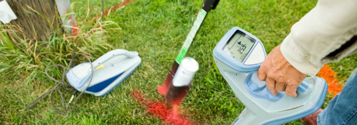
Private Utility Locating for Commercial Renovations in Sacramento, CA
Commercial renovation projects require comprehensive subsurface infrastructure mapping to prevent costly utility strikes and regulatory violations. Private utility locating services identify water lines, electrical conduits, irrigation systems, and telecommunications infrastructure beyond public meter connections that 811 systems do not cover. Sacramento contractors face strict California regulations requiring advanced detection technologies and documentation standards that protect against financial liability while ensuring worker safety.
Urban subsurface network complexity has increased demand for private utility surveys among commercial developers and renovation specialists. Projects involving foundation work, underground parking installation, or utility relocation depend on accurate mapping to maintain schedules and budgets. Contractors who prioritize private locating services reduce strike risks while satisfying regulatory compliance requirements.
Key Takeaways
- Private utility locating covers 60% of subsurface infrastructure not included in free 811 services
- Utility strikes cost contractors an average of $4,000 in direct repairs, with indirect costs multiplying by 29
- Ground Penetrating Radar detects both metallic and non-metallic utilities, unlike electromagnetic methods
- California enforces tolerance zones of 18-24 inches around marked utilities requiring hand excavation
- The North American utility locating market will reach $4.11 billion by 2032, with 7.3% annual growth
What Is Private Utility Locating and Why Is It Essential?
Private utility locating identifies subsurface infrastructure on private property beyond public utility connection points using electromagnetic detection, Ground Penetrating Radar, and vacuum excavation to map utilities that property owners maintain and control.
Commercial renovation utility locating prevents damage to infrastructure that 811 services do not mark or document. Accurate subsurface mapping protects contractors from legal liability while ensuring project timelines remain intact.
What Differentiates Private Utility Locating from Public Services?
The 811 system marks public utilities only up to the meter connection, where responsibility transfers to property owners, creating a responsibility gap covering private infrastructure representing 60% of total subsurface utilities. Public locating services exclude private water lines, electrical conduits serving outbuildings, irrigation networks, or telecommunications cables installed by property owners.
Private utilities beyond the meter remain unmapped by free 811 services despite their prevalence across commercial properties. Understanding the regulations surrounding utility line marking in California helps contractors navigate this complex responsibility structure.
Which Utilities Are Covered by Private Locating?
Private locating services identify water lines extending from meter connections to buildings and landscape irrigation systems. Electrical conduits powering detached structures, security lighting, and site equipment fall under private utility categories. Underground telecommunications cables, fiber-optic lines, and data transmission infrastructure installed for specific properties require private detection methods.
Irrigation systems represent a significant portion of private utilities on Sacramento commercial projects, requiring careful mapping. Private water mains, fire suppression lines, and drainage systems all fall outside public 811 coverage boundaries.
Why Is Private Utility Locating Critical for Commercial Renovations?
Direct repair costs average $4,000 per utility strike, with indirect costs multiplying this figure by 29. Service disruptions create cascading delays affecting project schedules, labor allocation, and client relationships. Legal liability for contractors includes both repair costs and penalties for regulatory violations that can reach six figures.
Safety hazards from striking gas or electrical lines create immediate dangers requiring emergency response and site evacuation. Workers face electrocution risks from damaged electrical conduits and explosion hazards from ruptured gas lines. The risks of not prioritizing utility marking for construction sites extend beyond financial losses to include serious injury potential and project shutdowns.
How Do Sacramento Contractors Prioritize Utility Locating Services?
Sacramento contractors allocate resources across multiple service categories based on project requirements and regulatory obligations. Private utility locating services command 35% of market share, reflecting the critical gap in public 811 coverage. Commercial excavation support captures 28% of spending, while liability risk mitigation services account for 22% of contractor investments.
Concrete scanning services represent 10% of market activity, with the remaining demand distributed across specialized applications. These allocation patterns demonstrate how contractors balance cost control against strike prevention across Sacramento commercial projects.
What Are the Key Service Categories Used by Contractors?
Private utility locating services dominate contractor spending at 35% of the total market share for subsurface detection. Commercial excavation support captures 28% through comprehensive site scanning and subsurface mapping. Liability risk mitigation services account for 22% through documentation and compliance verification.
Concrete scanning represents 10% of market activity focused on identifying rebar and post-tension cables in existing structures. Other specialized services, including leak detection and underground storage tank location, comprise the remaining 5%.
How Do Accuracy and Compliance Influence Provider Choice?
Contractors rank accuracy in depth and location determination as their highest priority at 28% importance ratings. Regulatory compliance capabilities account for 24% of the selection criteria, reflecting California’s strict excavation laws. Speed of service represents 22% of decision factors as project schedules demand rapid turnaround for locating activities.
Cost efficiency influences 16% of provider selection decisions, balancing budget constraints against accuracy requirements for renovation utility mapping. Safety standards account for 10%, reflecting contractor obligations for worker protection. Choosing the best utility marking company for your business needs requires evaluating these factors against specific project requirements.
Which Contractor Types Most Frequently Adopt Private Locating?
Municipal contractors demonstrate 92% adoption rates driven by strict public works requirements. Excavation specialists show 85% adoption rates as their core operations depend entirely on safe digging practices. Utility companies maintain 78% adoption rates for internal projects involving infrastructure expansion and maintenance.
General contractors achieve 72% adoption rates across diverse project types requiring subsurface clearance. Commercial renovators report 68% adoption rates reflecting growing awareness of private utility risks in Sacramento commercial projects.
What Technologies Are Used for Utility Locating in Sacramento?
Electromagnetic locating provides fast, cost-effective detection for metallic utilities, including copper water lines and steel gas pipes. Ground Penetrating Radar delivers comprehensive scanning capabilities, detecting both metallic and non-metallic infrastructure with excellent depth penetration. Acoustic methods and vacuum excavation offer specialized detection and verification capabilities for complex subsurface environments.
Technology selection depends on utility types, soil conditions, and accuracy requirements specific to each Sacramento renovation project. Contractors often combine multiple detection methods to achieve comprehensive subsurface mapping. Advanced providers integrate these technologies with GPS positioning and 3D mapping software for precise documentation.
How Do Electromagnetic and Ground Penetrating Radar Compare?
Electromagnetic locating excels at detecting metallic utilities with fast scanning speeds and low operational costs. However, electromagnetic methods cannot detect PVC pipes, concrete conduits, or fiber-optic cables common in modern Sacramento commercial projects. This technology provides moderate depth capability suitable for utilities within six feet of the surface.
Ground Penetrating Radar detects both metallic and non-metallic utilities with excellent depth capability reaching fifteen feet or deeper. GPR equipment costs significantly more than electromagnetic locators and requires moderate scanning speeds for thorough coverage. GPR struggles in high-clay soils common throughout California, requiring experienced operators to interpret subsurface reflections accurately.
When Are Vacuum Excavation and Acoustic Methods Applied?
Acoustic and sonic methods provide good detection for both metallic and non-metallic utilities with moderate depth capabilities. These technologies cost more than electromagnetic locating but less than Ground Penetrating Radar, with moderate scanning speeds for focused investigation areas.
Vacuum excavation delivers Quality Level A data through visual confirmation of subsurface utility locations and depths. Potholing in California provides definitive verification but carries high costs and slow operational speeds compared to remote sensing methods. Contractors use vacuum excavation strategically at critical conflict points where absolute certainty justifies the additional expense.
What Are the Cost and Speed Trade-offs Among These Technologies?
Electromagnetic locating offers the fastest scanning speeds at the lowest costs, making it ideal for initial surveys across large sites. Ground Penetrating Radar balances comprehensive detection capabilities against higher equipment costs and moderate operational speeds, providing the best return on investment for complex projects requiring complete subsurface mapping.
Vacuum excavation represents the slowest and most expensive detection method, but it delivers absolute verification, eliminating uncertainty. Contractors optimize technology selection by using electromagnetic or GPR methods for initial mapping, followed by targeted vacuum excavation, controlling costs while ensuring accuracy at critical utility crossing points.
How Do California Regulations Impact Utility Locating Practices?
California requires contractors to contact USA North 811 at least two business days before digging activities commence. State regulations enforce strict tolerance zones around marked utilities requiring hand excavation within 18-24 inches of identified infrastructure. These requirements create compliance obligations that significantly influence utility locating practices throughout Sacramento.
Regulatory frameworks establish liability standards holding contractors responsible for utility strikes resulting from inadequate investigation or improper excavation methods. Penalties range from state fines up to $100,000 to federal pipeline safety violations reaching $2,000,000 for serious incidents. Compliance costs continue rising with projected increases of 10% in 2025.
What Is the Role of the 811 System and Its Limitations?
The 811 system provides free utility marking for public infrastructure up to property meter connections throughout California. Contractors must contact USA North 811 at least two business days before excavation. Public locating services cover water, gas, electrical, and telecommunications infrastructure owned and maintained by utility companies.
System limitations create responsibility gaps for private utilities beyond meter connections that property owners control. This 60% of subsurface infrastructure remains unmapped by 811 services despite representing significant strike risks. Underground utilities in California extend well beyond public systems, requiring comprehensive private locating services for complete subsurface mapping.
How Do Tolerance Zones and Excavation Methods Affect Compliance?
California enforces tolerance zones of 18-24 inches around marked utilities where mechanized equipment is strictly prohibited. Contractors must use hand tools or vacuum excavation within these zones to prevent strikes. Mechanized equipment operation within tolerance zones constitutes regulatory violations regardless of whether actual utility damage occurs.
Hand excavation increases labor costs but provides precise control, reducing strike risks near identified utilities. Vacuum excavation offers non-destructive investigation within tolerance zones, combining speed advantages with regulatory compliance for Sacramento commercial projects.
What Are the Liability Risks and Penalties for Utility Strikes?
California imposes state-level fines reaching $100,000 for excavation violations, including inadequate investigation and improper digging methods. Federal Pipeline and Hazardous Materials Safety Administration penalties can reach $2,000,000 for pipeline damages. Direct repair costs average $4,000 per strike, with indirect costs including delays, legal fees, and reputational damage multiplying this by 29.
Contractors face criminal liability for gross negligence causing injuries or fatalities from utility strikes. Insurance premiums increase following strike incidents, while severe violations can result in license suspensions or revocations. These consequences make comprehensive private utility surveys essential risk management investments.
What Are the Best Practices for Managing Liability and Project Risks?
Private utility locating mitigates legal exposure by documenting subsurface infrastructure before excavation activities commence on Sacramento commercial projects. Comprehensive detection services provide defensible records demonstrating due diligence in utility investigation and strike prevention efforts. Contractors who invest in thorough locating services significantly reduce liability risks while protecting project budgets and schedules.
Documentation and verification processes establish clear chains of custody proving compliance with California excavation regulations and industry standards. Integration of locating data into project planning enables proactive conflict resolution before construction activities encounter subsurface obstacles.
How Does Private Locating Mitigate Legal and Financial Exposure?
Private locating services document subsurface conditions, providing evidence of reasonable investigation efforts during excavation projects. This documentation establishes legal defenses against negligence claims resulting from utility strikes. Comprehensive mapping reduces strike frequency, protecting project budgets from repair costs and schedule delays averaging tens of thousands of dollars.
Insurance carriers recognize private locating as effective risk mitigation, reducing premium costs and claim frequencies. Legal protections extend to regulatory compliance, demonstrating adherence to California excavation requirements. Four reasons why utility marking is crucial for your home improvement project apply equally to commercial renovations requiring similar liability protections.
What Documentation and Verification Processes Are Recommended?
Subsurface Utility Engineering follows ASCE 38-22 standards, establishing four quality levels from preliminary research to visual verification. Quality Level D provides a desktop review of existing records, while Level C adds surface geophysical surveys. Quality Level B delivers horizontal positioning through surveyed measurements, while Level A requires visual confirmation through vacuum excavation.
Documentation packages should include marked site plans, depth measurements, utility classifications, and photographic evidence. GPS coordinates and GIS integration enable precise location tracking, supporting future excavation activities and facility management throughout building lifecycles. Digital documentation systems provide searchable archives accessible to multiple project stakeholders.
How Do Contractors Integrate Locating Data Into Project Planning?
Integration begins during pre-construction phases when locating data informs site layout decisions and excavation sequencing strategies. CAD software imports utility mapping data, enabling conflict analysis between proposed construction activities and existing subsurface infrastructure, preventing design conflicts that would otherwise require costly field modifications.
Excavation contractors use locating data to optimize equipment selection and digging methods based on utility locations and depths. Project managers incorporate buffer zones around identified utilities into construction schedules, allowing adequate clearances for safe excavation. Real-time access to digital locating data enables field crews to make informed decisions when encountering unexpected subsurface conditions.
Which Market Trends Are Shaping Utility Locating in Sacramento?
The global private utility locating market reached $1.82 billion in 2024, with projections indicating growth to $2.68 billion by 2032, representing a compound annual growth rate of 5.7% driven by infrastructure modernization and regulatory compliance demands. The broader utility locator market, including equipment and public services, was valued at $913.78 million in 2024, with projections reaching $1.48 billion by 2032 at 6.28% annual growth.
North American markets dominate global activity, accounting for 36.8% of market share in 2023. Regional markets demonstrate accelerated growth rates exceeding global averages as aging infrastructure requires replacement and renovation activities intensify.
How Are Technological Advances Influencing Locating Services?
Advanced Ground Penetrating Radar systems deliver higher resolution imaging, enabling detection of smaller utilities and precise depth measurements. GPS integration provides centimeter-level positioning accuracy, supporting Geographic Information System mapping and digital twin creation. Mobile applications enable real-time data sharing between field crews and project managers, improving decision-making during excavation.
3D visualization software transforms subsurface data into interactive models, helping contractors understand complex utility networks before excavation. Artificial intelligence algorithms assist in GPR data interpretation, reducing operator training requirements while improving detection accuracy. These technological advances lower operational costs while improving service quality throughout Sacramento commercial renovation projects.
What Regional Differences Affect Service Adoption and Methods?
North America accounted for 36.8% of the global market share in 2023, with values reaching $2.33 billion in 2024. Regional projections indicate growth to $4.11 billion by 2032, representing compound annual growth of 7.3%. This accelerated growth reflects stringent regulatory requirements and extensive infrastructure networks requiring ongoing maintenance.
California’s complex subsurface environments and strict excavation regulations drive higher adoption rates compared to national averages. Urban Sacramento projects demand comprehensive Ground Penetrating Radar scanning, while suburban developments may rely more heavily on electromagnetic detection. Soil composition variations throughout the region influence technology selection, with clay-heavy areas requiring specialized GPR interpretation expertise.
How Are Costs and Regulatory Requirements Evolving Over Time?
Budget tier private utility locating services range from $150 to $400 for simple residential applications using electromagnetic detection only. Mid-range services cost $400 to $800 for residential projects requiring Ground Penetrating Radar verification. Premium residential and small commercial projects exceed $800, reflecting complex site conditions.
Commercial excavation support services range from $800 to $2,500 for small commercial sites covering one to five acres. Mid-range commercial projects spanning five or more acres cost $3,000 to $10,000 for complete subsurface mapping. Complex industrial or campus-wide mapping projects exceed $15,000 to $25,000, reflecting extensive survey areas and Quality Level A verification requirements.
How Are Private Utility Locating Services Applied in Sacramento Renovations?
Case studies from Sacramento commercial projects demonstrate substantial return on investment from comprehensive private utility locating services. A downtown Sacramento contractor prevented $45,000 in damages by identifying three abandoned gas lines and an active private water main. These utilities were not documented on city maps, highlighting the critical value of thorough subsurface investigation.
Commercial campus projects benefit from pre-construction utility mapping that enables proactive coordination between renovation activities and existing infrastructure. Ground Penetrating Radar scans reveal unmarked private utility lines, allowing design adjustments before excavation activities encounter conflicts.
What Do Case Studies Reveal About Utility Locating Benefits?
A downtown Sacramento contractor renovating a historic building near the State Capitol required extensive trenching for new fiber-optic installations. Private utility locating using electromagnetic and Ground Penetrating Radar methods identified three abandoned gas lines and an active private water main, preventing an estimated $45,000 in potential damages and avoiding project delays that would have multiplied costs.
A commercial campus project contracted private locators to scan a multi-acre site before soil boring activities commenced. The Ground Penetrating Radar scan revealed that several proposed boring locations were directly above unmarked private utility lines. Adjusted boring coordinates allowed environmental testing to proceed safely, demonstrating how private utility surveys enable successful project execution.
How Does Locating Support Pre-Construction and Excavation Phases?
Pre-construction utility mapping enables accurate cost estimating by identifying subsurface conflicts requiring design modifications or specialized excavation methods. Design teams use locating data to optimize building placement, utility routing, and site access strategies before construction documents reach completion, preventing costly change orders.
Excavation phase support provides real-time verification as contractors expose utilities during digging activities, confirming pre-construction mapping accuracy. Field locating services respond quickly to unexpected subsurface discoveries, enabling rapid decision-making that maintains project schedules. Continuous locating support protects against strikes while providing documentation supporting regulatory compliance and quality assurance requirements.
What Challenges Arise in Urban Versus Suburban Renovation Projects?
Urban Sacramento projects encounter dense subsurface networks, including decades of abandoned utilities, creating complex detection challenges. Historic buildings often lack accurate as-built documentation, requiring comprehensive Ground Penetrating Radar scanning to map existing conditions. High-clay soils common in urban areas complicate GPR interpretation, requiring experienced operators to distinguish utilities from geological features.
Suburban renovation projects typically feature newer infrastructure with better documentation, reducing detection complexity compared to urban environments. Lower utility density simplifies subsurface mapping but does not eliminate strike risks from unmarked private utilities. Suburban sites may include extensive irrigation systems and private drainage networks requiring thorough investigation despite seemingly straightforward surface conditions.
Private Utility Locating for Commercial Renovations in Sacramento: Integrated Solutions for Risk Reduction and Regulatory Compliance
Private utility locating has become essential infrastructure for Sacramento commercial renovation projects requiring comprehensive subsurface mapping beyond public 811 coverage. Advanced technologies, including Ground Penetrating Radar and vacuum excavation, enable accurate detection of both metallic and non-metallic utilities. Contractors who prioritize private locating services significantly reduce liability exposure while ensuring regulatory compliance.
Market growth projections indicate continued expansion as infrastructure complexity increases and regulatory requirements become more stringent across California. Technology integration with GPS positioning and 3D mapping software provides contractors with powerful tools for proactive project planning. Comprehensive utility locating protects project budgets, maintains schedules, and ensures worker safety across Sacramento commercial projects of all scales.
Coastline Utility provides specialized subsurface detection services, helping contractors navigate complex utility networks throughout California commercial projects. Professional locating services deliver the accuracy and documentation necessary for successful renovation project execution.
Map What’s Below Before You Break Ground
Commercial renovations don’t leave room for surprises underground. A single strike on an unmarked private line can stall your schedule, drain your budget, and put your crew at risk. Coastline Utility locates the water lines, electrical conduits, irrigation networks, and telecom infrastructure that 811 leaves unmarked, then hands you clear documentation that holds up against California compliance requirements.
Get accurate subsurface mapping before the first cut. Contact our team to schedule a private utility locating for your commercial renovation.
