Clicky

underground utility infrastructure

GPR vs. Electromagnetic Utility Locating

Commercial construction projects demand accurate subsurface information before excavation begins. Utility strikes cost contractors thousands in delays, repairs, and safety violations. The global utility locator market reached $1.03 billion in 2026 and is projected to grow at 6.02% annually through 2031.

Two technologies dominate the field: Ground Penetrating Radar and electromagnetic locating. Each method offers distinct advantages depending on site conditions, utility types, and project requirements. Understanding when to deploy each technology prevents costly mistakes and ensures regulatory compliance.


Key Takeaways

  • GPR detects both metallic and non-metallic utilities, while EM locates only conductive lines unless tracer wire is installed
  • Every dollar spent on utility mapping produces $11.39 in savings through reduced relocation costs and project delays
  • EM equipment costs $1,500 to $8,000, while GPR systems range from $10,000 to over $70,000 for premium models
  • The oil and gas sector accounts for 28.60% of the utility locating market share, with telecommunications growing at 7.46% annually
  • Hybrid approaches combining GPR and EM are becoming standard practice for complete subsurface mapping in congested urban sites

How Each Technology Works

Ground Penetrating Radar (GPR)

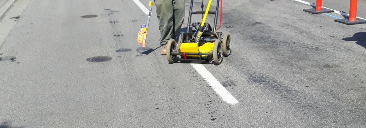
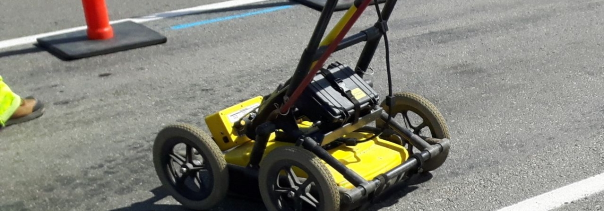
Ground Penetrating Radar uses high-frequency radio waves to detect buried objects by analyzing signals reflected from changes in subsurface material properties. The system transmits pulses into the ground and records echoes that bounce back from underground features. The resulting data creates a cross-sectional image showing utility locations, depths, and soil layers beneath the surface.

Electromagnetic (EM) Locating

Electromagnetic locating induces a specific frequency onto a conductive utility line and traces the resulting electromagnetic field using a receiver. The transmitter applies an electrical signal to the target line, creating a magnetic field that radiates outward. An operator walks the site with a receiver, identifying the signal strength and position to map the utility’s horizontal path.

What Each Can Detect

GPR detects both metallic and non-metallic utilities, including PVC pipes, concrete structures, and fiberglass conduits. The technology responds to changes in subsurface density regardless of material conductivity. Electromagnetic locating detects metallic utilities only, unless a tracer wire is installed alongside non-conductive infrastructure. Copper, steel, and aluminum lines carry signals effectively, while plastic and concrete remain invisible to EM receivers.

GPR vs. EM: Head-to-Head Comparison

DimensionGround Penetrating Radar (GPR)Electromagnetic (EM) Locating
Utilities detectedMetallic and non-metallicMetallic only (unless tracer wire is installed)
Depth estimationSuperior depth estimationLess precise on depth
SpeedGenerally more time-consumingFaster
CostHigher capital investmentMore affordable
Soil and environmentEffectiveness is highly dependent on soil; wet clay severely limits penetrationThe main environmental challenge is signal bleed-off in congested urban areas
Urban congestionComprehensive imaging across congested sitesSignal complications and bleed-off to adjacent metallic structures
Market share (2025)Commanded 46.40% of market share

What the Comparison Means

GPR wins on detection range and depth: it sees non-metallic lines and estimates depth more accurately than electromagnetic methods. The technology provides comprehensive subsurface imaging that reveals utilities missed by EM scans. Electromagnetic survey benefits include faster operation and lower costs for known metallic lines. Equipment investments start below $2,000, making EM accessible to small contractors with limited budgets.

Neither method is universally superior; the right choice depends on the site conditions and project scope. Urban projects with mixed utility materials favor GPR, while rural metallic-only sites suit EM locating. Most commercial construction projects now combine both technologies for complete coverage.

When to Use Each Technology

Site Conditions and Technology Selection

Use GPR where non-metallic lines—PVC, concrete, or fiberglass—or unknown utilities are present, or where depth must be confirmed. Accurate depth estimation prevents excavator strikes during trenching and prevents damage to underground utility infrastructure. Use EM where target lines are known and metallic, and speed or budget is the priority. Tracing existing power, gas, and communication lines works efficiently with electromagnetic receivers when the material composition is documented.

Urban vs. Rural Preferences

Congested urban sites raise EM signal bleed-off risk, favoring GPR or a combined approach for accurate mapping. Adjacent metallic structures create interference that complicates signal interpretation, requiring experienced operators to distinguish target utilities from background noise. Open or known-metallic sites suit faster, lower-cost EM locating without the environmental challenges that reduce radar penetration. Rural pipeline corridors and transmission line projects typically deploy EM as the primary method.

Why a Hybrid Approach Is Becoming Standard

A hybrid approach combines EM rapid metallic detection with GPR comprehensive imaging for complete utility mapping across diverse site conditions. The utility locating methods comparison shows complementary strengths: EM confirms conductive line positions, while GPR reveals non-metallic infrastructure and subsurface voids. Contractors reduce liability by verifying data through dual-technology verification before excavation begins.

Why the Comparison Matters in Commercial Construction

Common Applications by Sector

The oil and gas sector accounts for 28.60% of the market in 2025, driven by pipeline expansion and maintenance projects. Petroleum infrastructure relies heavily on electromagnetic methods to trace metallic pipelines across long distances. The telecommunications sector is growing at 7.46% annually as fiber-optic network deployment accelerates nationwide. Fiber installation requires GPR to avoid damaging existing non-metallic conduits that EM systems cannot detect.

Accuracy, Speed, and Safety Stakes

Seventy-eight percent of respondents identified the lack of accurate utility locating as the weakest element in the 811 damage prevention process. Inaccurate subsurface data leads directly to utility strikes, project delays, and safety incidents that halt construction. Fifty-six percent of contractors cited response time issues as a major weakness in current locating services. Slow turnarounds force project managers to choose between waiting for accurate data or proceeding with incomplete information.

Cost, ROI, and the Business Case

Equipment Costs Compared

GPR equipment requires substantial capital investment: basic units start around $10,000, while premium 3D systems exceed $70,000 for advanced imaging. Complete systems average $65,000, including accessories, training, and software for professional utility line locator operations. EM equipment costs significantly less: professional mid-range models cost $1,500 to $5,000 for reliable metallic detection. Premium multi-frequency models reach $8,000 but remain far below GPR investment thresholds.

ROI From Subsurface Utility Engineering (SUE)

Every $1.00 spent on utility mapping produced $11.39 in savings through reduced relocation costs and design changes. Projects using comprehensive subsurface data experienced 40.33% reduction in relocation costs compared to excavation without mapping. Construction and design costs dropped 29.46%, while redesign costs fell 9.59% when accurate utility data informed planning. Project delays decreased 9.08% when contractors identified conflicts before mobilizing equipment.

Case Studies in Cost Avoidance

Virginia DOT invested $93,553 in test holes and utility locating, identified 75 potential conflicts, and eliminated 61 before construction. The proactive approach avoided $731,425 in utility adjustments for net savings of $637,872 on a single project. Maryland State Highway Administration invested $5,000 in SUE, avoided major utility conflicts, and realized $300,000 in savings. Relocation time dropped by four to six months, accelerating project delivery and reducing overhead costs.

Who Adopts Each Technology

Workforce and Demographic Trends

The median age of the construction workforce is 42 years, indicating an experienced labor pool familiar with traditional methods. Millennials and Generation X comprise 71% of the workforce, representing tech-savvy professionals receptive to advanced detection systems. Younger workers adopt GPR technology faster than older cohorts, driving gradual industry-wide shifts from electromagnetic-only operations to hybrid approaches.

Firm Size and Budget Constraints

Ninety-nine point nine four percent of construction companies are classified as small businesses, which pushes many firms toward EM’s lower equipment cost. Limited capital budgets prevent small contractors from purchasing GPR systems outright, forcing them to rent equipment or subcontract locating services. Large engineering firms invest in both technologies to serve diverse project types, while smaller operations specialize in one method or partner with professional utility marking companies for comprehensive coverage.

Emerging Technologies Beyond GPR and EM

AI-Based Subsurface Prediction

4M Analytics uses machine learning to analyze satellite imagery, aerial photos, historical maps, and public utility records before fieldwork begins. The system identifies surface clues—fire hydrants, manholes, and utility poles—to infer subsurface infrastructure location with increasing accuracy. AI analyzes patterns invisible to human observers, predicting utility corridors that field teams verify using GPR and EM.

Detection Integrated With Excavation

RodRadar offers real-time utility detection integrated into excavator buckets, automatically halting digging operations when conductors are detected. The system provides immediate feedback to operators, preventing strikes before damage occurs rather than relying on pre-excavation surveys alone. Integration reduces human error by removing the gap between locating data and excavation execution.

The Verdict: GPR Vs. EM for Commercial Construction

GPR and EM are not rivals so much as complementary tools: GPR for non-metallic lines and depth, EM for fast, low-cost metallic detection. Choosing the right utility locating technique depends on project scope, known infrastructure, and site complexity. Site conditions, utility materials, and congestion decide which method leads on a given job, with hybrid approaches becoming standard practice.

The hybrid approach is becoming the standard because it captures the strengths of both technologies while compensating for individual limitations. Commercial projects demand complete subsurface data, which no single technology provides across all conditions. GPR utility detection advantages include comprehensive imaging of mixed-material infrastructure, while EM delivers rapid metallic tracing at accessible price points.

Coastline Utility uses both EM and GPR to deliver complete utility locating for commercial construction projects and residential applications across the Central Coast and SF Bay Area. The ground penetrating radar vs. electromagnetic debate misses the point: effective subsurface mapping requires both technologies deployed strategically based on site-specific conditions.

Get Both Technologies on Your Next Job Site

The wrong locating method leaves utilities undetected and your crew exposed. Coastline Utility runs electromagnetic and GPR side by side, so metallic lines, PVC, concrete, and unknown infrastructure all get mapped before your excavator touches the ground. You get accurate depth, complete coverage, and the documentation you need to stay compliant on Central Coast and SF Bay Area projects. Request a free quote or schedule your locating service.

Underground utilities in California

Utility Locating for Commercial Construction Projects

Commercial construction utility locating identifies and maps underground infrastructure before excavation to prevent strikes, delays, and cost overruns. Professional locating combines Ground Penetrating Radar, electromagnetic technology, and engineering analysis to document subsurface conditions on dense urban and suburban sites. Accurate utility identification services have become essential planning steps as commercial projects face increasingly congested underground environments where historical records are incomplete or missing. The documented return on investment from early subsurface mapping now drives adoption across all commercial project types and sizes.


Key Takeaways

  • Ground Penetrating Radar detects both metallic and non-metallic utilities, while electromagnetic locating traces conductive lines faster and at a lower cost
  • Subsurface Utility Engineering delivers USD 11.39 in savings for every dollar invested, with documented reductions in delays and redesign costs
  • Commercial sites require hybrid locating approaches due to dense, poorly documented utility networks that increase strike risk
  • AI-based predictive mapping and real-time excavator detection are expanding the toolkit, but physical verification remains the professional standard
  • Accurate utility identification services protect project timelines and budgets by eliminating the schedule disruption and liability exposure that utility strikes create

What Utility Locating Means for Commercial Construction

Definition and Purpose

Commercial construction utility locating uses specialized detection equipment to identify and mark buried infrastructure before ground disturbance begins. Public 811 tickets cover only publicly owned lines in the right-of-way, so commercial sites rely on Private Utility Locating to find the private utilities that one-call systems leave off the map. Electromagnetic locators induce a specific frequency onto conductive utility lines and trace the resulting electromagnetic field using a receiver. Ground Penetrating Radar uses high-frequency radio waves to detect buried objects by analyzing signals reflected from changes in subsurface material properties. Subsurface Utility Engineering combines civil engineering, surveying, geophysics, and geospatial expertise into one discipline that documents underground conditions to engineering standards.

Why Accurate Subsurface Mapping Is Critical on Commercial Sites

Commercial sites carry dense, mixed, and often poorly documented utility networks, so mapping errors translate directly into delays and cost overruns. An Associated General Contractors survey found 78% of respondents identified a lack of accurate utility locating as the weakest element in the 811 damage prevention process. Additionally, 56% of contractors cited response time issues as a major weakness in existing one-call systems, which rely on utility companies to mark only their own public lines. How to choose the best utility marking company for your business needs helps commercial teams understand the selection criteria that prevent these documented gaps from impacting project schedules.

The Core Technologies: GPR and EM

Ground Penetrating Radar (GPR)

Ground Penetrating Radar excels in dry sandy soils, but effectiveness is highly dependent on soil conditions. Penetration depth is severely limited in highly conductive soils such as wet clay, restricting its use in certain site conditions. GPR proves more time-consuming than electromagnetic locating and requires higher capital investment than EM equipment. Basic units start around USD 10,000, while premium 3D ground-penetrating radar systems exceed USD 70,000, with complete systems averaging USD 65,000.

Electromagnetic (EM) Locating

Electromagnetic locating is excellent for metallic detection, with fast operation and low to moderate cost ranging from USD 1,500 to USD 8,000. The technology performs well across a wide range of soil types, making it reliable in variable conditions. EM cannot detect non-metallic utilities unless tracer wire was installed alongside the original infrastructure. Signal bleed-off occurs when EM signals transfer to adjacent metallic structures in congested areas, requiring skilled interpretation.

Choosing the Right Method for a Commercial Site

Site Conditions and Utility Types

Match the method to the soil and the utility material: GPR for non-metallic lines and mixed conditions, EM for known metallic lines. Many commercial projects use both methods together to cross-verify results and achieve comprehensive documentation. Four reasons why utility marking is crucial for your home improvement project explain the verification principles that also apply to industrial dig planning on larger commercial sites.

Urban Vs. Rural Locating Challenges

Congested urban commercial sites raise the risk of EM signal bleed-off, which favors GPR or a hybrid verification approach. Rural areas with predominantly metallic utilities and lower density allow EM locating to remain the preferred, cost-effective method. Urban construction site hazard assessment must account for closely spaced infrastructure that increases the probability of unintentional strikes during excavation.

Equipment Cost and Contractor Decision Drivers

GPR equipment requires substantial capital investment, with basic units starting around USD 10,000 and premium 3D systems exceeding USD 70,000. EM equipment proves considerably more accessible, with professional mid-range models costing between USD 1,500 and USD 5,000. Small firms, which comprise 99.94% of construction companies, often outsource locating to specialized providers equipped with premium technology.

Commercial Project Applications and Use Cases

Commercial Construction

Site development, foundations, parking structures, and tenant improvements all require subsurface mapping before excavation to prevent utility conflicts. Accurate locating protects existing service to occupied or adjacent buildings during construction, maintaining business continuity for tenants. High-rise excavation safety depends on comprehensive subsurface documentation because foundation depths increase strike risk on deep utilities. Underground utilities in California present unique challenges due to seismic retrofitting and layered infrastructure installations across multiple construction eras.

Telecommunications and Fiber Deployment

The telecommunications sector is expanding at 7.46% CAGR, driving demand for utility identification services that prevent damage to existing fiber networks. New fiber installations require precise mapping of existing conduits to avoid conflicts that delay deployment schedules. Underground utility locating in San Jose, CA, supports the region’s dense technology infrastructure, where fiber networks support data centers and corporate campuses across Silicon Valley.

Oil, Gas, and Infrastructure Projects

The oil and gas sector accounts for 28.60% of the utility locating market in 2025, reflecting the critical safety requirements. Pipeline projects require comprehensive subsurface mapping to protect both the new installation and existing infrastructure from accidental contact. Underground utility locating in Oakland, CA, serves industrial zones where aging infrastructure requires careful documentation before any ground disturbance begins.

The Economic Impact on Commercial Projects (ROI)

Return on Investment From Subsurface Utility Engineering (SUE)

Every USD 1.00 spent on utility mapping produced USD 11.39 in savings across documented highway construction projects. SUE delivered a 40.33% reduction in project relocation costs and a 29.46% reduction in construction and design costs. The methodology also achieved a 9.59% reduction in redesign costs and a 9.08% reduction in project delays. These documented savings demonstrate why commercial teams now treat subsurface mapping as a standard planning step rather than an optional expense.

Commercial Case Studies

Virginia DOT invested USD 93,553 in Richmond and avoided USD 731,425 in utility adjustments, producing net savings of USD 637,872. Maryland State Highway Administration spent USD 5,000 on SUE and realized USD 300,000 in savings while cutting relocation time by 4 to 6 months. What are the risks of not prioritizing utility marking for construction sites? The liability exposure that these documented case studies successfully avoided through early investment.

Reducing Delays and Mitigating Risk

The 9.08% delay reduction and the case study outcomes show how early locating removes the schedule and liability risk utility strikes create. Utility damage can halt commercial work for days or weeks while repairs proceed and regulatory investigations conclude. Utility locating service providers equipped with both GPR and EM technology deliver the hybrid verification approach that commercial projects require.

Emerging Technologies Shaping Utility Locating

AI-Based Predictive Mapping

4M Analytics uses AI to analyze satellite imagery for utility prediction, creating baseline utility maps before physical fieldwork begins. AI analyzes satellite imagery, aerial photos, historical maps, and public utility records to identify infrastructure patterns. The technology identifies surface clues such as fire hydrants, manholes, and utility poles that indicate subsurface connections. AI infers the likely location of connected subsurface infrastructure, but physical locating using GPR and EM provides verification of predictions.

Real-Time Detection Equipment

RodRadar integrates detection into excavator buckets for real-time utility detection, automatically halting operations when infrastructure is encountered. This integration reduces operator reliance on pre-marked locations and adds a final safety layer during active excavation. Real-time systems complement rather than replace traditional surface marking, creating redundant protection against utility strikes.

Hybrid Utility Locating Methodologies

The 3D GPR market is projected to expand at 9.0% CAGR through 2036 as contractors adopt comprehensive imaging technology. Hybrid approaches combine EM speed for initial metallic tracing with GPR confirmation for complete subsurface documentation. Field findings then convert into precision GPS mapping and CAD drawings, so the resulting CAD files integrate directly into the project design model. Industry consensus now favors dual-technology verification on commercial projects where utility density and poor historical records increase strike risk.

Market and Regional Trends

Market Size and Growth

The global utility locator market reached USD 1.03 billion in 2026 and is projected to reach USD 1.38 billion by 2031. The broader market reflects a Compound Annual Growth Rate of 6.02% driven by infrastructure development and regulatory requirements. North America holds approximately 37% of the revenue share in 2024, valued at USD 2.33 billion. Asia Pacific shows a projected CAGR of 8.03% through 2032, fueled by urbanization and smart city development.

Technology Adoption Across Firm Sizes

The broader SUE services market could expand from USD 2.64 billion in 2026 to USD 13.31 billion by 2035. Electromagnetic locating commanded 46.40% of the market share in 2025, while GPR is growing at 6.52% CAGR. Small businesses comprise 99.94% of construction companies, creating a large market for both equipment sales and outsourced locating services. The median age of the construction labor force is 42 years, indicating a tech-savvy workforce receptive to digital tools.

Regulatory and Safety Influences

State damage-prevention laws and 811 requirements continue to drive adoption of professional locating across commercial work nationwide. OSHA enforcement and liability exposure from utility strikes push contractors toward comprehensive documentation before excavation begins. Regulatory frameworks vary by state, but the trend favors mandatory private locating on commercial projects where public one-call systems prove insufficient.

Plan Your Next Commercial Dig With Coastline Utility

A single utility strike can stall a commercial schedule for days and expose your crew to serious liability, while the documented 11:1 return on subsurface mapping shows how quickly accurate locating pays for itself. Coastline Utility pairs Ground Penetrating Radar with electromagnetic locators to map both public lines and private utilities, then turns the field results into precision GPS mapping and CAD files your design team can use right away. As a female-owned, family-run company serving contractors across the Central Coast and Bay Area, we deliver fast turnarounds, clear reporting, and the hybrid verification that commercial sites depend on. Contact Coastline Utility to schedule your locate before the first shovel hits the ground.

underground utilities in California

Best Practices for Safe Digging in California

Excavation projects carry serious safety risks that demand attention before the first shovel breaks ground. Trenching and underground work account for 40 fatalities annually across construction sites, with California enforcing some of the strictest safety requirements in the nation. Understanding proper protocols protects workers, supports public safety, prevents costly utility strikes, and keeps projects compliant with state law.

California’s Safe Dig Act and Cal/OSHA regulations establish clear requirements for excavation notification and worker protection. Following systematic procedures—from pre-dig planning through final inspection—reduces liability exposure and avoids delays that can cost tens of thousands of dollars. This guide provides actionable frameworks that contractors and property owners can implement immediately on any digging project.


Key Takeaways

  • Call 811 and DigAlert at least two working days before excavation, but hire professionals to locate private utilities not covered by public services
  • Use Electromagnetic locating for metallic utilities and Ground Penetrating Radar for comprehensive subsurface detection, including non-metallic materials
  • Install protective systems for trenches deeper than 5 feet and assign an OSHA Competent Person to conduct daily inspections
  • California fines reach $50,000 for Safe Dig Act violations, and utility strikes cost an average of $4,000 in direct repairs, plus 29 times more in cleanup
  • Every dollar spent on utility locating services saves $4.62 in damage prevention, making professional locating a proven investment

Why Safe Digging Practices Matter

Cave-ins represent the greatest threat to workers performing excavation and trenching operations on construction sites. A single trench collapse can bury workers in seconds, leaving little time for rescue and often resulting in fatal injuries. Beyond worker safety, California enforces the Safe Dig Act with penalties reaching $50,000 for violations, plus full liability for repair costs when excavators strike underground utilities without proper notification.

Sound excavation practices protect crews and preserve project schedules while avoiding the financial burden detailed throughout this guide. Excavation-related damages to underground utilities in California contribute to the $30 billion annual cost of underground infrastructure strikes nationwide. Implementing proven safety protocols before work begins eliminates preventable incidents that destroy budgets and reputations.

The Core Safe Digging Practices

Notify and Plan Before You Dig

Contact 811 at least 2-3 days before excavation to initiate the national dig notification service. California law requires separate notification to DigAlert at least two working days before digging anywhere in the state. These locate requests cover public utilities only and do not identify private lines such as irrigation systems, landscape lighting, or property-specific infrastructure.

Identify all surface encumbrances across the work area before equipment arrives on site. Classify soil as Type A, B, or C to determine appropriate protective measures and ensure compliance with utility locating regulations and CA standards.

Locate Both Public and Private Utilities

Verify that public utilities have been properly marked through your 811 and DigAlert request. Professional locators must be hired separately to detect non-public utilities using Electromagnetic (EM) and Ground Penetrating Radar (GPR) technologies. EM locating identifies metallic pipes, cables, and tracer wires embedded in the ground.

GPR detects both metallic and non-metallic materials, including PVC pipe, concrete structures, and subsurface voids. Combining these technologies provides comprehensive coverage that protects against strikes to all subsurface installations present at the site.

Verify, Mark, and Document

Pothole every marked utility location before machine digging by hand-excavating or using vacuum excavation methods. Hand-dig within the required 18-24 inch tolerance zone surrounding every marked utility to confirm exact location and depth. This verification step prevents equipment damage to lines that may have shifted from their marked positions.

Record all locate data using GPS coordinates and site photographs to create a defensible project record. Documentation proves due diligence if disputes arise and provides a valuable reference for future work in the same area.

Protect the Trench and Workers

Install protective systems for any trench exceeding 5 feet in depth using hydraulic shoring, aluminum trench shields, or steel trench boxes. Provide ladders or ramps positioned within 25 feet of all workers in trenches deeper than 4 feet. Keep heavy equipment and excavated spoil piles at least 2 feet away from the trench edge to prevent loading that could trigger collapse.

These construction site safety protocols are not optional recommendations but mandatory requirements under Cal/OSHA regulations. Failure to implement proper protective systems exposes companies to citations, fines, and liability for preventable injuries.

Monitor and Maintain Compliance On Site

Assign a Competent Person holding OSHA Competent Person Certification to oversee all excavation work. This designated individual must perform daily atmospheric testing for hazardous gases and conduct structural inspections of protective systems. Daily inspections by the Competent Person continue throughout the excavation lifecycle, with additional inspections required after rain events or any incident that could affect trench stability.

Continuous monitoring catches developing hazards before they cause injuries or equipment damage. The Competent Person has the authority to halt work immediately if unsafe conditions develop at any point during the project.

Utility Locating Technologies: EM Vs. GPR

How the Two Methods Differ

EM locating targets metallic infrastructure, including pipes, cables, and tracer wires installed alongside non-metallic utilities. GPR detects metallic and non-metallic materials such as PVC, concrete, and voids without relying on conductivity. EM provides cost-effective, fast, and reliable detection for known metallic lines, while GPR delivers comprehensive subsurface views that reveal unexpected utility lines and buried infrastructure.

EM cannot detect non-conductive materials, limiting effectiveness on sites with extensive PVC or fiber optic installations. GPR carries higher equipment costs and operates more slowly than EM, but detects both metallic and non-metallic targets. Professional locators in Alameda, Contra Costa, and San Francisco typically combine both technologies for complete coverage.

Market Use and Accuracy

EM locators command approximately 45% of the utility detection equipment market. GPR systems hold roughly 25% market share despite higher costs due to superior detection capabilities. GPR performance is affected by soil moisture and composition, with typical depth penetration reaching 3-6 meters in favorable conditions.

Depth accuracy within ±5-10% represents a critical performance requirement for preventing utility strikes during excavation. RTK and GPS integration improve mapping precision by providing centimeter-level coordinate data for every detected utility.

California Regulations and Enforcement

The Governing Rules

California Government Code 4216, commonly known as the Safe Dig Act, anchors California Excavation Law and governs excavation notification requirements throughout the state. Cal/OSHA establishes excavation and trenching safety standards through Article 6 of the Construction Safety Orders, codified in Title 8 of the California Code of Regulations. Protective systems become mandatory by OSHA regulation for any trench exceeding 5 feet in depth.

Competent Person Certification is required for OSHA compliance on all excavation projects. Understanding regulations surrounding utility line marking in California prevents violations that carry severe financial and legal consequences for contractors.

Enforcement and Fatality Trends

California imposes fines up to $50,000 for Safe Dig Act violations plus full liability for repair costs. OSHA issued 629 citations for excavation safety violations during 2024 as enforcement activity increased. Excavation and trenching produce some of the most severe accidents and fatalities in construction, claiming approximately 40 lives annually across the industry nationwide.

Trenching and excavation deaths spiked to 39 fatalities in 2022 alone. This represented a 160% increase from just 15 fatalities recorded in 2021, prompting intensified regulatory scrutiny and enforcement.

The Cost and ROI of Safe Digging

Equipment Pricing Tiers

Budget and entry-level equipment under $1,000 includes basic cable tracers and magnetic locators suitable for simple projects. Mid-range equipment priced $1,000-$3,000 includes professional models like the Leica DD120 and Schonstedt u-LOCATE. High-end locators costing $3,000-$6,000, such as the Radiodetection RD8200, offer advanced features and deeper penetration.

Premium survey-grade systems exceeding $6,000 incorporate RTK-enabled positioning for centimeter-level mapping accuracy. EM locator pricing ranges from $800 to $15,000, depending on capabilities, while GPR systems cost $15,000 to $50,000 or more.

The Cost of a Utility Strike

Excavation-related damages to underground utilities cost approximately $30 billion per year across the United States. The average direct repair cost per utility strike incident reaches $4,000 for fixing damaged infrastructure. However, cleaning up a utility strike costs 29 times more than repairing the physical damage itself when accounting for project delays, emergency response, legal fees, and reputational harm.

Many Sacramento contractors reduce liability with private utility locating services that prevent these catastrophic cost multipliers. A single avoided strike typically pays for professional locating services across multiple projects.

The Return on Safe Digging

Professional utility locating delivers measurable financial returns for every dollar invested in pre-excavation safety. For every $1 spent on utility locating services, projects save an average of $4.62 through damage prevention. Safety training programs deliver an ROI of $4 to $6 for every dollar invested when accounting for reduced injury costs and improved productivity.

Companies typically allocate 2.6% of their budgets to safety training compared to 3.6% spent on workplace injuries. Reallocating resources toward prevention rather than incident response produces superior financial outcomes while protecting workers and infrastructure.

Quick-Reference Safe Digging Checklist

This condensed list provides crews with essential California dig permits and safety verification steps for every excavation project.

  • [ ] Call 811 (2-3 days out) and DigAlert (2 working days out) before excavation
  • [ ] Confirm 811 / DigAlert covers public utilities only and arrange private locating separately
  • [ ] Identify surface encumbrances and classify soil as A, B, or C
  • [ ] Locate metallic lines with EM and metallic plus non-metallic lines with GPR
  • [ ] Pothole to verify exact location and depth before machine digging
  • [ ] Hand-dig within the 18-24 inch tolerance zone
  • [ ] Record locate data with GPS coordinates and photographs
  • [ ] Install protective systems for trenches deeper than 5 feet
  • [ ] Provide ladders or ramps within 25 feet of workers in trenches deeper than 4 feet
  • [ ] Keep equipment and spoils at least 2 feet from the trench edge
  • [ ] Assign an OSHA Competent Person on site
  • [ ] Run daily atmospheric testing and structural inspections

Understanding why utility marking is crucial for your home improvement project helps property owners recognize that these steps apply to residential work as well. Following earth-moving equipment guidelines and systematic verification prevents costly mistakes regardless of project scale.

Safe digging practices protect lives, preserve infrastructure, and prevent financial disasters on construction sites across California. The protocols outlined in this guide represent proven methods contractors use daily to maintain compliance with state regulations while protecting workers and underground utilities. Investing in professional locating services, proper training, and protective equipment delivers measurable returns that far exceed the upfront costs of comprehensive safety programs.

Coastline Utility serves contractors and property owners throughout the Central Coast and San Francisco Bay Area with advanced utility locating and potholing in California using state-of-the-art equipment and experienced technicians. Their comprehensive approach combines EM and GPR technologies to ensure complete subsurface detection before excavation begins.

Locate With Coastline Utility Before You Break Ground

Safe digging starts with knowing exactly what sits below the surface. Coastline Utility helps contractors and property owners across the Central Coast and San Francisco Bay Area locate public and private utility lines before a digging project begins, pairing electromagnetic and GPR locating with experienced field technicians. The team marks every line accurately, documents each find, and keeps your work aligned with California Excavation Law and Cal/OSHA requirements. Contact Coastline Utility today to schedule professional utility locating and protect your crew, your budget, and your timeline.

utility marking and locating services

Utility Locating Checklist Before Excavation

Excavation projects expose crews to serious risks when underground utilities remain unmarked. A complete utility locating checklist protects workers, infrastructure, and project budgets from preventable damage. Every dig site contains subsurface lines for water, gas, electricity, and telecommunications that require identification before excavation begins.

The true cost of utility strikes extends far beyond immediate repair expenses. Project delays, emergency response, and hidden costs multiply damage repair expenses by 29 times the initial fix. Following a systematic pre-excavation safety plan reduces these risks while ensuring compliance with California and federal regulations.


Key Takeaways

  • Utility locating identifies subsurface lines before excavation, preventing $30 billion in annual damages across the United States
  • Call 811 at least 2-3 days before digging for public utility marking and arrange private utility locating separately
  • Ground Penetrating Radar (GPR) and electromagnetic utility detection locate both metallic and non-metallic lines accurately
  • California Safe Dig Act requires compliance with Government Code 4216, with fines reaching $50,000 for violations
  • Protective systems are mandatory for trenches deeper than 5 feet, with daily inspections by an OSHA Competent Person

What Utility Locating Is and Why It Matters Before You Dig

Utility locating prevents excavation crews from striking buried infrastructure during construction activities. Professional locators use specialized equipment to map subsurface utilities before any digging begins. This process identifies the exact position and depth of water lines, gas pipes, electrical cables, and telecommunication networks. Accurate utility mapping protects workers from injury and prevents service disruptions affecting entire communities.

The financial impact of skipping utility locating far exceeds the service cost. Excavation-related damages to underground utilities cost the United States approximately $30 billion per year. The average direct repair cost per utility strike incident reaches $4,000, but hidden costs, including project delays and emergency response, multiply total expenses significantly. For every dollar spent on utility marking and locating services, contractors save $4.62 from damage and downtime prevention.

The Purpose of Utility Locating

Utility locating finds and marks subsurface utilities, so crews know what lies below before breaking ground. This process protects water lines, gas pipes, electrical cables, and telecommunication networks from accidental strikes. Professional locators use electromagnetic utility detection for metallic lines and ground penetrating radar (GPR) for non-metallic materials. Both technologies provide precise depth measurements and horizontal positioning data.

Accurate utility identification prevents catastrophic failures that endanger workers and the public. Gas line strikes create explosion risks, while electrical cable damage causes electrocution hazards and widespread power outages. Water main breaks flood active construction sites and disrupt service to surrounding properties. Telecommunication cable damage interrupts emergency services and business operations across affected areas.

The Real Cost of Skipping It

The $30 billion annual cost of excavation-related damages represents only measurable direct expenses. The average direct repair cost per utility strike incident is $4,000 for materials and labor. However, hidden costs multiply damage repair costs by 29 times through project delays and emergency response. Lost productivity, equipment rental extensions, and regulatory fines compound the financial impact.

Project delays from utility strikes halt construction schedules for days or weeks pending repairs. Emergency response costs from utility damage include after-hours contractor rates and utility company mobilization fees. The ROI of $4.62 for every $1 spent on utility locating services makes professional marking an essential investment rather than an optional expense.

The Pre-Excavation Utility Locating Checklist

A comprehensive utility locating checklist ensures no critical steps are missed before excavation begins. Following this systematic approach protects workers, infrastructure, and project timelines from preventable incidents. Each step builds upon the previous one to create a complete subsurface utility map.

The checklist is divided into five distinct phases covering notification, location, verification, site preparation, and ongoing monitoring. Skipping any single step compromises the entire safety system and exposes projects to liability. Complete documentation at each phase provides evidence of due diligence for regulatory compliance.

Step 1: Notify and Plan (2 to 3 Days Before You Dig)

Call 811 at least 2-3 days before excavation to reach the national dig notification service. Confirm that 811 marks public utilities only and does not mark private lines on your property. This free service coordinates with utility companies to send locators to your site. Public utilities include municipal water, gas, electric, and telecommunication lines maintained by service providers.

Classify the soil type as A, B, or C according to OSHA standards for proper shoring selection. Identify surface encumbrances on the site, including pavement, landscaping, and existing structures that affect excavation methods. Soil classification determines protective system requirements and influences the choice of excavation equipment. Surface conditions impact utility detection accuracy and may require additional investigation before locating begins.

Step 2: Locate Public and Private Utilities

Confirm public utilities have been marked through the 811 request before proceeding with excavation planning. Arrange professional private utility locating for non-public lines, including irrigation, septic, private water, and electrical services. Private utilities fall outside 811 coverage and require specialized locating services to map accurately. Many sites contain both public and private infrastructure requiring complete underground utility mapping.

Use electromagnetic (EM) locating for metallic utilities, including steel and copper pipes and cables. Use ground penetrating radar (GPR) for both metallic and non-metallic utilities, including PVC, concrete, and fiber optic lines. EM locators detect electromagnetic fields generated by energized lines or applied tracer signals. GPR systems transmit radar pulses into the ground and measure reflected signals from subsurface objects.

Step 3: Verify and Document Each Utility

Pothole the site using hand-digging or vacuum excavation to confirm the exact location and depth. Hand-dig within the 18-24 inch tolerance zone around every marked utility before operating machinery. Visual verification eliminates uncertainty about utility positioning and reveals any unmarked infrastructure. Potholing services provide direct observation of subsurface conditions without extensive excavation.

Record locate data with GPS coordinates for future reference and regulatory documentation. Document all findings with photographs showing utility positions, depths, and surrounding conditions. GPS mapping creates permanent records that benefit future projects on the same site. Photographic evidence supports compliance reporting and insurance claims if incidents occur despite precautions.

Step 4: Set Up the Site for Safe Digging

Install protective systems for any trench deeper than 5 feet, including shoring, shields, or boxes. Provide ladders or ramps within 25 feet of workers in trenches deeper than 4 feet. These requirements protect workers from cave-ins and ensure safe egress during emergencies. Protective systems must match soil classification and excavation depth specifications.

Keep heavy equipment at least 2 feet from the trench edge to prevent edge collapse. Keep excavated spoils at least 2 feet from the trench edge to reduce surcharge loads. Equipment vibration and spoil pile weight destabilize trench walls and increase cave-in risk. Proper clearances maintain structural integrity throughout the excavation period.

Step 5: Monitor Conditions During Excavation

Assign an OSHA Competent Person to oversee excavation safety and enforce protective system use. Perform daily atmospheric testing for oxygen deficiency, toxic gases, and explosive vapors in confined trenches. The Competent Person must have training to recognize hazards and the authority to stop work. Atmospheric conditions change rapidly in trenches, requiring continuous monitoring throughout each shift.

Conduct daily structural inspections of trench walls, protective systems, and adjacent areas. Inspections must occur before each shift, after rain events, and following any ground disturbance. Daily documentation provides evidence of ongoing compliance with safety regulations. Structural deterioration develops quickly in excavations, making frequent assessment essential for worker protection.

Excavation Safety Regulations and Compliance

Federal and state regulations establish minimum safety standards for all excavation activities. Compliance protects workers from preventable injuries while shielding companies from regulatory penalties and civil liability. California utility line marking regulations impose stricter requirements than those of many other states.

Understanding applicable regulations helps contractors develop effective utility dig compliance programs. Regulatory requirements address notification, protective systems, competent person qualifications, and documentation standards. Penalties for non-compliance range from citations to criminal charges in cases involving fatalities.

California Requirements: Safe Dig Act and Cal/OSHA

California Government Code 4216 Safe Dig Act requires excavators to contact regional notification centers before digging. Cal/OSHA Article 6 Section 1541 establishes construction safety orders for excavations and trenching operations. The Safe Dig Act mandates at least two working days’ notice before excavation begins. Cal/OSHA regulations specify protective system requirements, inspection protocols, and competent person qualifications.

Fines up to $50,000 apply for failure to comply with the California Safe Dig Act. Excavators remain liable for all repair costs and consequential damages resulting from utility strikes. Criminal penalties may apply in cases involving gross negligence or willful violation of safety standards. Civil liability extends to property damage, service interruptions, and personal injuries caused by utility strikes.

Federal OSHA Requirements

OSHA Competent Person Certification is required for excavation safety oversight on all federal and most private projects. The competent person must complete training covering soil classification, protective systems, atmospheric hazards, and inspection protocols. Certification demonstrates knowledge of OSHA excavation standards and the ability to recognize hazardous conditions. Companies must designate competent persons in writing and provide documentation during inspections.

Federal OSHA standards apply to all construction employers regardless of state location. State-plan states like California may enforce standards equivalent to or more stringent than federal requirements. OSHA conducts workplace inspections and issues citations for excavation safety violations. Serious violations carry penalties up to $16,131 per occurrence, with higher amounts for willful violations.

Trenching Hazards and Protective Systems

Cave-ins pose the greatest risk to excavation workers, causing more fatalities than all other excavation hazards combined. Trenching and excavation rank among the most hazardous construction activities based on injury and fatality rates. A cubic yard of soil weighs approximately 3,000 pounds, creating crushing forces impossible to survive. Workers have seconds to escape once a cave-in begins, making prevention the only effective protection.

Protective systems are required for trenches deeper than 5 feet according to OSHA and Cal/OSHA standards. Trench shoring uses protective systems, including hydraulic supports, aluminum shields, and steel boxes, to prevent cave-ins. Hydraulic shoring systems provide adjustable support that adapts to varying trench widths and soil conditions. Aluminum trench shields and steel trench boxes create protected zones where workers can operate safely.

Why Compliance Pays Off

Companies spend 2.6% of their budgets on safety training compared to 3.6% spent on treating injuries. This imbalance reveals the cost-effectiveness of prevention compared to incident response and recovery. Safety training programs deliver an ROI of $4 to $6 for every dollar invested. Reduced insurance premiums, fewer lost-time incidents, and improved productivity contribute to measurable financial returns.

Contractors who prioritize utility locating experience fewer project delays and lower liability exposure. Compliance creates competitive advantages through improved bid acceptance rates and client retention. Safety performance increasingly influences project awards as owners recognize the correlation between safety records and project outcomes. Strong safety cultures attract skilled workers and reduce turnover costs in competitive labor markets.

Excavation Safety by the Numbers

Statistical analysis reveals patterns in excavation incidents that inform prevention strategies. Fatality trends, citation patterns, and workforce demographics provide context for safety program development. These numbers demonstrate both the severity of excavation hazards and the effectiveness of proper precautions.

Industry data guides resource allocation and training priorities for maximum impact. Understanding who performs excavation work helps tailor safety communications and compliance programs. Numbers translate abstract risks into concrete evidence supporting investment in protective measures.

Trenching Fatalities and Enforcement Trends

Excavation and trenching cause 40 fatalities annually on average in the United States. Trenching and excavation deaths totaled 39 in 2022, following 15 fatalities in 2021. This represents a 160% increase in fatalities from 2021 to 2022, prompting intensified enforcement. OSHA issued 629 citations for excavation safety violations in 2024 as part of heightened emphasis programs.

The fatality spike reflects both increased construction activity and persistent compliance gaps. Many incidents involve preventable causes, including inadequate protective systems and absent competent person oversight. Citations target repeat violators and companies demonstrating systemic safety failures. Enhanced enforcement aims to improve compliance through deterrence and public awareness.

Who Relies on Utility Locating (Industry Context)

Los Angeles employs over 308,000 construction workers across residential, commercial, and infrastructure projects. Latino workers comprise 40% of California’s construction workforce, with Hispanic workers representing 31.1% nationally. Black workers comprise 5.1% of the construction labor force, while Asian workers represent 1.8%. Construction demographics influence safety communication strategies and training delivery methods.

Workers age 55 or older represent 22.7% of construction employees, bringing experience but facing age-related injury risks. Non-union workers comprise 87% of California’s construction workforce, requiring diverse safety training approaches. Demographic diversity necessitates multilingual safety materials and culturally appropriate training methods. Effective utility marking programs address the needs of varied workforce populations through inclusive communication.

Quick-Reference Pre-Excavation Checklist

This condensed utility locating checklist provides job site crews with essential steps for safe excavation. Print and carry this reference to ensure no critical safety measures are overlooked. Each checkbox represents a required action before or during excavation activities.

Complete all items in sequence to maintain proper safety protocols throughout the project. Missing even one step compromises worker protection and regulatory compliance. Use this checklist daily and file completed copies as documentation.

Pre-Excavation Safety Checklist:

  • Call 811 at least 2-3 days before excavation
  • Confirm 811 covers public utilities only, and arrange private utility locating separately
  • Classify soil as A, B, or C and identify surface encumbrances
  • Locate metallic lines with EM and metallic plus non-metallic lines with GPR
  • Pothole to verify the exact location and depth before the machine digs
  • Hand-dig within the 18-24 inch tolerance zone
  • Record locate data with GPS coordinates and photographs
  • Add protective systems for trenches deeper than 5 feet
  • Place ladders or ramps within 25 feet of workers in trenches deeper than 4 feet
  • Keep equipment and spoils at least 2 feet from the trench edge
  • Assign an OSHA Competent Person on site
  • Run daily atmospheric testing and structural inspections

Following this systematic approach reduces utility strike risk while maintaining compliance with excavation safety regulations. Proper documentation demonstrates due diligence and supports a positive safety culture. Consistent checklist use protects workers, infrastructure, and project success from preventable incidents.

Schedule Utility Locating Before Your Next Dig

A checklist only works when accurate subsurface data backs it up. Coastline Utility maps underground water, gas, electrical, and telecommunication lines using ground penetrating radar (GPR) and electromagnetic detection, giving your crew the exact positions and depths needed to excavate safely and stay compliant with the California Safe Dig Act.

As a family-owned team serving contractors and developers across the Central Coast and San Francisco Bay Area, we deliver clear locate documentation, fast turnarounds, and the verification your project requires before the first shovel hits the ground.

Contact Coastline Utility today to schedule professional utility locating and protect your workers, your timeline, and your budget.